Key Takeaways:
- Ghanja La Chuli, called Naya Kanga by most climbers, is a glaciated Group B trekking peak south of Kyanjin Gompa.
- It stands on the Rasuwa and Sindhupalchok border, with its main summit inside Gosaikunda Rural Municipality, dividing Langtang from Helambu.
- Right beside the peak, the 5,130 m Ganja La offers a three-day camping crossing to Helambu with no settlements.
- Its look changes with your position: Kyanjin shows the north face, the Ganja La the north-east, and Helambu the south.
- Nobody can confirm the first ascent, and the best-documented climb is a 2014 winter ascent of the north-east face couloir.
- The trekking peak label hides real snow and glacier travel, so first-timers need guided instruction before attempting this climb.
- The north-east ridge holds one 40 to 55 degree snow section needing a belay, so skills outweigh logistics.
- Plan 12 to 16 days from Kathmandu, including acclimatization hikes above Kyanjin and a spare weather day.
- Permits go through NMA-registered agencies only, and royalties since 1 September 2025 are USD 350 in spring, USD 175 otherwise.
- The 26 August 2026 flood damaged the Syabrubesi road, yet Langtang reopened, with two alternative approaches via Betrawati and Helambu.
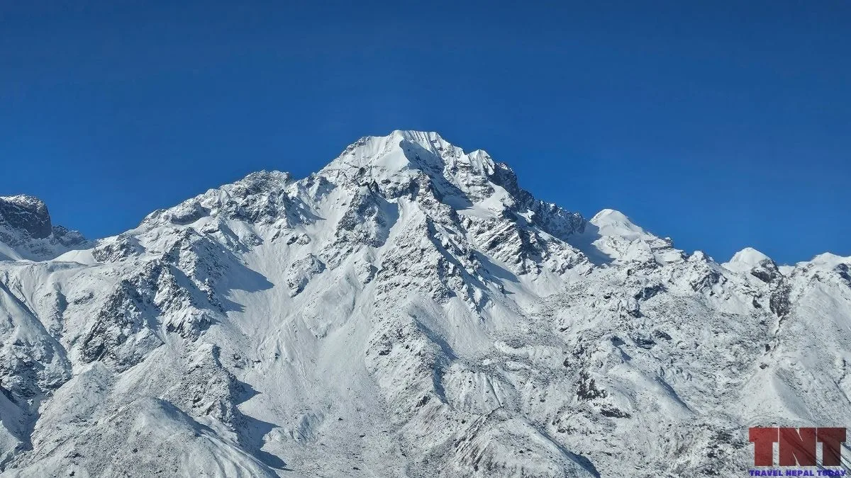
Ghanja La Chuli is a glaciated peak of about 5,844 m that rises south of Kyanjin Gompa, on the opposite side of the Langtang Khola from the village where most Langtang trekkers turn around.
The Nepal Mountaineering Association (NMA) lists it as a Group B trekking peak, and climbers usually call it Naya Kanga (or Naya Khanga).
In this blog, we explain where the peak sits, why it has two names, who climbed it first (or why nobody can say), which sides of it you can see from Kyanjin and from the Ghanja La, and how the normal route works.
The last sections cover a short itinerary, permits, and the state of the Langtang Valley trail after the August 2026 flood.
Key Facts About Ghanja La Chuli
| Names | Ghanja La Chuli, Naya Kanga. Also written Ganja La Chuli, Naya Kang, Naya Khang, Naya Khanga |
| Height | 5,863 m |
| Location | Gosaikunda Rural Municipality, Rasuwa District, Bagmati Province |
| Range | Langtang Himal |
| Coordinates | 28°10′06″N 85°33′05″E |
| Classification | NMA Group B Peak (trekking peak) |
| Normal Route | North-east ridge, graded PD+ (PD+/AD- in the American Alpine Journal). One snow section of 40 to 55 degrees needs belaying. |
| First Ascent | Not recorded. Several unsourced claims exist. |
| Camps | Base camp about 4,300 to 4,500 m, high camp about 4,900 to 5,000 m. |
| Foreign Climber Royalty | USD 350 (spring), USD 175 (autumn, winter and summer) per person, from 1 September 2025 |
| Trail Status | Langtang and Kyanjin reported reopened after the 26 August 2026 flood |
Ghanja La Chuli or Naya Khanga: What is Its Real Name?
Ghanja La Chuli is the name on the NMA’s peak listing. Chuli is the Nepali word for a peak, so the name reads roughly as “the peak of the Ganja La”, which makes sense because the mountain stands right beside that pass.
However, Naya Kanga is the name most climbers and maps use.
A 2014 climbing report by Oh Young-hoon explains how the two names came apart. According to the report, the government announced the peak as Kangja Chuli at 5,844 m and gave the NMA the job of managing it.
The NMA then listed it as Naya Kanga. The same report says the listed coordinates point to a spot about 5 km west of the summit his team climbed. It adds that two popular maps label the area differently: the HMG-Finn map puts the Naya Kanga name on that western point, while the Schneider map uses Urgen Kangri for the ridge.
The team could not settle which is correct, and the report says Lindsay Griffin, then the American Alpine Journal’s editor, favoured the Schneider version.
Where is Ghanja La Chuli?
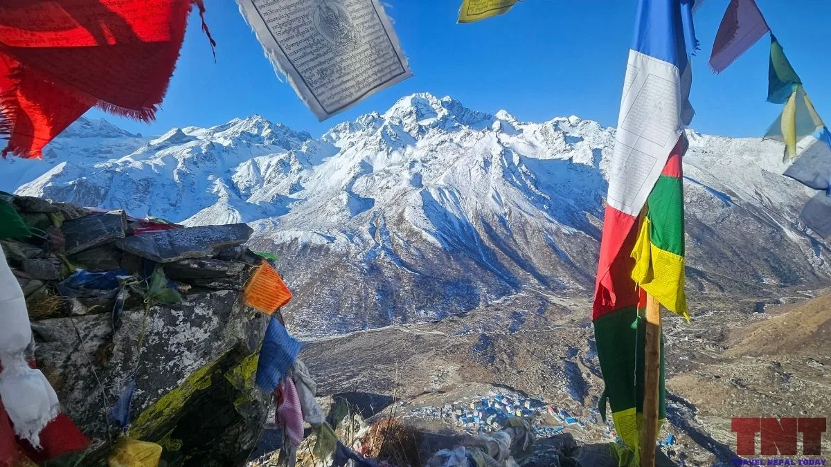
The peak stands on the southern side of the upper Langtang valley, inside Langtang National Park.
The mountain is located right on the border of Rasuwa and Sindhupalchok. However, zooming in on the map, we know that it’s majority of it and the main summit are located in Gosaikunda Rural Municipality, Rasuwa district.
The peak is located south of Kyanjin Gompa. The water from its north side drains into the Langtang Khola and on to the Bhote Koshi-Trishuli river system, while the south side drains through the Yangri Khola towards the Indrawati.
That puts the mountain (belonging to the Langtang Himal range) on the divide between the Langtang side and the Helambu side (both parts of the Langtang region).
The Ganja La: The Pass Next to the Peak
The Ganja La (also written Gangja La or Kangja La) is the high pass between the Langtang valley and Helambu. It sits just east of Ghanja La Chuli.
Its highest point is at 5,130 m, and crossing it is a different job from doing the standard Langtang trek!
The usual line leaves Kyanjin Gompa, crosses the Langtang Khola, climbs to the yak pastures of Ngegang (also spelled Nyengang) at roughly 4,000 m, then follows moraine to a base area below the pass.
After the glacier and snow of the crossing, the route drops to Keldang on the Helambu side, then to Yangri Kharka and the lower Helambu villages.
It is a camping crossing of about three days from Kyanjin, and there are no settlements between Kyanjin and the Helambu side.
Suggested Package: Ganja La Pass with Langtang Valley Trek from Himalayan Ecstasy Nepal
The pass and the peak share an approach! The climb is often built into a pass crossing.
You need to head toward the Ganja La first, then traverse west to the peak’s north-east ridge. So if you climb the peak first, the pass is the natural way out toward Helambu.
Western exploration of the upper Langtang began in 1949, when Bill Tilman and Peter Lloyd reached a col on the valley’s western rim that now carries Tilman’s name. Some say the pair also crossed the Ganja La but it’s not 100% sure.
Faces of Naya Kanga: Where to See It From?
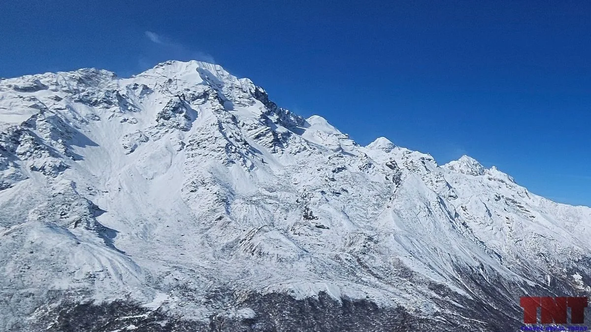
The record is thinner here than for the route, so this section separates what is documented from what is not.
| Where you stand | What you see of the peak |
|---|---|
| Kyanjin Gompa (3,870 m), Lower Kyanjin Ri (4,300 m), Kyanjin Ri (4,700 m), and Tsergo Ri (4,985 m) | The peak lies to the south/south-west direction, across the valley. You are looking at its north face, the side that drains to the Langtang Khola. |
| Ngegang and the Ganja La trail (4,000 to 4,430 m) | You climb the same south side. The north-east face and its glacier shelf come into closer view as you leave the pass trail. |
| Ganja La (about 5,100 to 5,130 m) | The peak is west of the pass, so you look at its eastern and north-eastern side. The route traverses west from the pass trail across a snow terrace. |
| Helambu side | The peak’s southern face is visible. |
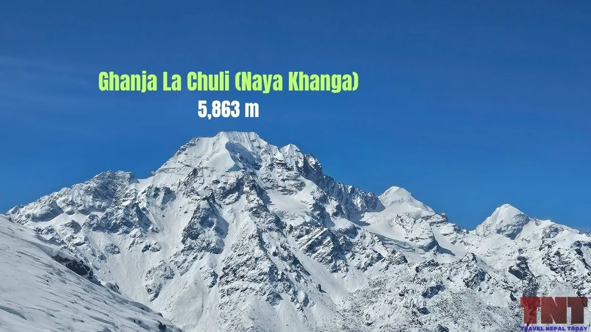
Four features of the mountain have been documented so far:
- North-east ridge:This is the normal route, graded PD+ (PD+/AD- in the AAJ). One section of 40 to 55 degree snow needs belaying!
- North-east face: Kim Jin-Seok and Oh Young-hoon climbed its central couloir in 2014 (graded D for the whole ascent). They approached around the right side of a large serac barrier.
- Summit ridge: The north-east ridge widens to a small col on an east-west summit ridge, with the summit about 30 m higher. The Korean report describes a 400 m east-west snow ridge on its own line.
- North ridge. The “north-east ridge” and “north ridge” can be use interchangeably.
Climbing History
Before diving into the records, it is worth noting that tracking the climbing history of Ghanja La Chuli (Naya Kanga) reveals a fascinating mix of undocumented lore, early exploratory footprints, and modern technical ascents on its demanding north-east face.
Who Made the First Ascent?
Nobody can say for certain! Honestly, it seems no one knows who climbed the peak first, but most reliable sources suggest Tilman, though that attribution rests on his 1949 exploration of the valley, not on a recorded summit.
Some say that Laurice Nielson and Ang Gyalzen Sherpa on 25 April 1984 were the first summiters. Another says climbers first summited it in the 1960s.
A Korean report adds a useful caution, quoting Lindsay Griffin’s view that Langtang is a place where people have long climbed without permits, and that most peaks there, apart from the very high and difficult ones, have probably been climbed already!
The Ascents That are Documented
The best-documented ascent is the 2014 winter climb by Kim Jin-Seok and Oh Young-hoon, written up by the American Alpine Journal.
They warmed up on the easy east ridge of Gangja La Peak (5,652 m), the first peak east of the pass.
Then, they climbed the central couloir of Naya Kanga’s north-east face and came down the normal route.
How Often Is It Climbed And Who Should Climb It?
Langtang’s accessibility from Kathmandu and the number of lower peaks around Kyanjin make it a good choice for a short climbing trip!
Does that make it a good first peak? Well, it can be, with conditions. “Trekking peak” is an administrative label, not a technical grade. The AAJ grade of PD+/AD- means real snow and glacier travel, and the route has a steep section that needs a rope and belaying.
If you have only done non-technical peaks, plan on guided instruction with ice axe, crampons and rope use before you leave Kyanjin.
Good reasons to choose it:
- Short access from Kathmandu: Langtang region is the nearest Himalayan national park to the capital.
- Built-in acclimatization: Kyanjin Ri and Tsergo Ri give you high day hikes before the climb.
- A genuine but moderate snow climb: It is a step up from walk-up peaks without the commitment of a 6,000 m objective.
- A way out through Helambu: The Ganja La lets you finish the trip on a different valley.
A poor reason is expecting an easy walk because the word “trekking” appears in the category. Another is choosing it only for the number on the height. The summit area is exposed, and weather can change quickly.
The Normal Route in Plain Words
Most climbers approach Ghanja La Chuli via the north-east ridge, following the Ganja La pass trail before breaking off onto the glacier. While the logistics are straightforward, the climb demands solid snow-travel skills and a roped belay on the upper pitch.
Here is how the ascent breaks down from Kyanjin Gompa to the summit:
- Cross the valley: From Kyanjin Gompa, you cross the Langtang Khola on a bridge and climb through juniper and rhododendron to the Ngegang yak pastures (about 4,000 m).
- Follow the pass trail: You continue on the moraine along the Ganja La trail to base camp.The base camp is roughly 500 m above Kyanjin, which is about 4,300 to 4,500 m.
- Leave the pass trail: You climb more moraine to the eastern end of the glacier shelf below the north-east face. The high camp goes here, which is about 4,900 m to 5,000 m.
- Cross the terrace: You traverse west across the large snow terrace to a gully or shallow couloir that leads onto the crest of the north-east ridge.
- Climb the ridge: The ridge holds the 40 to 55 degree snow section where belaying is needed. It then widens toward the summit ridge.
- Summit and return: The final climb is approx. 5 to 7 hours from high camp. You descend the same way.
Caution: Watch for crevasses where the route turns west below the pass, and for the serac barrier below the face that the 2014 team climbed around.
A Short Suggested Itinerary for Ghanja La Chuli Peak Climbing
Here is a possible itinerary (however, if you’re interested, we suggest checking the dedicated packages from a reliable operator):
| Day | Plan | Approximate height |
|---|---|---|
| 1 | Kathmandu to the trailhead (see current access below) | about 1,500 m at Syabrubesi |
| 2 | Trek to Lama Hotel | about 2,450 m |
| 3 | Trek to Langtang village | about 3,400 m |
| 4 | Trek to Kyanjin Gompa | about 3,800 m |
| 5 | Acclimatisation hike to Kyanjin Ri or Tserko Ri | 4,773 m or about 5,000 m |
| 6 | Cross the Langtang Khola, trek to base camp | 4,300 to 4,500 m |
| 7 | Move to high camp | 4,900 to 5,000 m |
| 8 | Summit day, return to base camp or Kyanjin | 5,844 m |
| 9 | Spare weather day | |
| 10 to 13 | Return to Kyanjin, then down to the trailhead and Kathmandu (or cross the Ganja La toward Helambu) |
It takes roughly 12 to 16 days from Kathmandu including the trek in and out to complete the peak climb.
Note that the NMA prices permits by season: spring is March to May and autumn is September to November. Winter and summer are priced separately, and the 2014 winter ascent shows the peak can be climbed outside the main seasons too!
Permits, Fees and Rules
Ghanja La Chuli needs an NMA climbing permit, and permits are issued through NMA-registered agencies, not to individuals!
You also need a Langtang National Park entry permit. It costs roughly NPR 3,000 for the park for foreign nationals and NPR 1,000 for those from SAARC countries.
NMA royalties for peaks of 6,500 m and below changed on 1 September 2025, under revisions to the mountaineering regulations.
| Climber | Spring | Autumn | Winter and summer |
|---|---|---|---|
| Foreign (per person) | USD 350 | USD 175 | USD 175 |
| Nepali (per person) | NPR 20,000 | NPR 10,000 | NPR 5,000 |
Moreover, a refundable garbage deposit is also collected by the NMA, which is about USD 250 to USD 500. You need to confirm the amount with your agency.
Getting to Langtang After the August 2026 Flood
On 26 August 2026, a glacier collapsed on the north side of Langtang Lirung and sent a flood down the Bhote Koshi and Trishuli valleys.
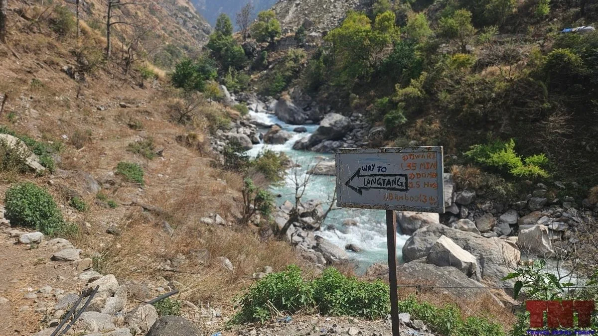
The road to Syabrubesi, the usual trailhead, was badly damaged. However, the Langtang trail above it runs through a different valley, along the Langtang Khola, and Ghanja La Chuli sits on that side.
As of November 2026, the Langtang Valley as well as Gosaikunda-Suryakunda has already reopened for trekking. There are two alternative approaches after a Bailey bridge was installed at Betrawati.
The first goes from Kathmandu through Trishuli and Betrawati to Dhunche or Thulo Syabru, then on through Bamboo, Lama Hotel and Langtang to Kyanjin. The second runs from Kathmandu via Chisapani, Helambu, Tharepati, Ghopte and Gosaikunda to Thulo Syabru, then the same trail to Kyanjin.
Conditions are still changing, so confirm the road, lodge availability and trail status with your agency a few days before departure!
Final Thoughts
Ghanja La Chuli is a peak with a lot of unfinished paperwork around it: two names, no recorded first ascent, and maps that disagree.
What is clear is the climb itself. A north-east ridge, a snow section that needs a rope, and a pass next door that gives you a way out.
Well, if you are planning to summit it, start with the permit rules and current road status, and ask your agency which summit and which height they are working from!
About The Author