Key Takeaways:
- Langtang Lirung is a 7,234 m peak in Rasuwa District, the highest of the Langtang Range, north of Kathmandu on the Tibet border.
- The mountain takes its name from the Langtang locality, not from a person.
- Seishi Wada and Pemba Tshering made the first ascent on October 24, 1978.
- Every side is steep and avalanche-prone, and the 2,200 m east face is the largest.
- The best Langtang Lirung views come from Lower Kyanjin Ri, Kyanjin Ri, and Tsergo Ri.
- The debris-covered tongue of Lirung Glacier thinned 1.3 to 1.8 m a year between 1974 and 2010.
- The April 25, 2015 earthquake set off an avalanche from this mountain that destroyed Langtang village.
- A rock and ice collapse from the north flank at 8:37 am on August 26, 2026 started the Bhotekoshi-Trishuli flood. Warming likely helped weaken the slope, but it was not the only cause.
- Foreign climbers need to pay a royalty of USD 800 in spring, USD 400 in autumn, and USD 200 in winter and summer in order to attempt the summit of Langtang Lirung.
- The debris bypassed the Langtang trekking valley, but Syaphru Bensi was hit, so use Dhunche to reach Langtang Valley.
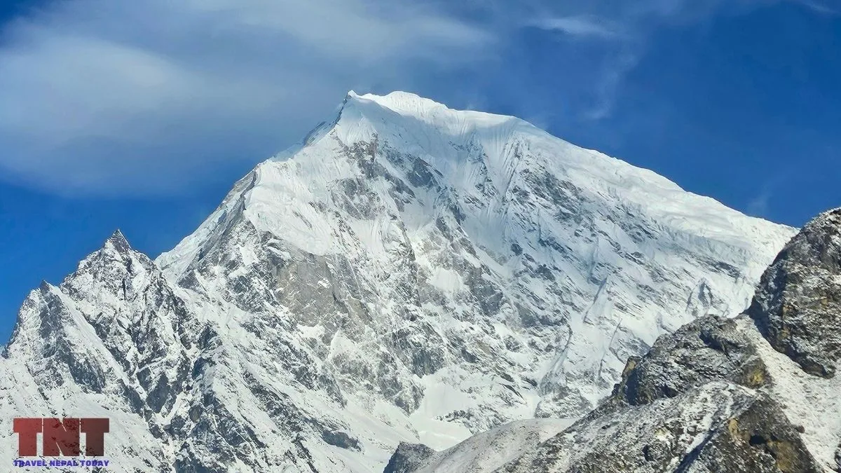
Langtang Lirung (7,234 m) is the highest peak of the Langtang Himal, a subrange of the Nepal Himalaya, north of Kathmandu. It stands in Rasuwa District, inside Langtang National Park, on the border with Tibet.
For decades, it was known to mountaineers as a steep, avalanche-prone peak that few teams summit, and to trekkers as the white mass that fills the northern sky above the Langtang Valley!
On August 26, 2026, the mountain became a global news story! A huge block of rock and glacier ice broke away from its north flank and triggered the flood that left almost 1,500 people dead (still counting) in Nepal and China, with thousands more missing.
This article covers the mountain from every side: its height, its name, who climbed it first, what each face looks like, where to view it, the Lirung Glacier, the science behind the 2026 collapse, and what a climbing permit costs today. Let’s start!
Key Facts About Langtang Lirung
| Location | Rasuwa District, Bagmati Province |
| Range | Langtang Himal |
| Elevation | 7,234 m |
| Prominence | 1,534 m |
| Main Glacier | Lirung Glacier, about 6.1 km², debris-covered |
| First Ascent | October 24, 1978, by Seishi Wada and Pemba Tsering, via the East Ridge |
| First Winter Ascent | January 3, 1988, by a Polish team |
| First Ascent of the East Face | October 30, 2024, by Marek Holeček and Ondrej Húserka |
| Foreign Climber Royalty (7,001 to 7,500 m category), may change in the future | USD 800 in spring, USD 400 in autumn, USD 200 in winter and summer (effective September 1, 2025) |
| Major Disasters | April 2015 avalanche onto Langtang village; August 26, 2026 north-flank collapse |
Langtang Lirung Height: How Tall Is It?
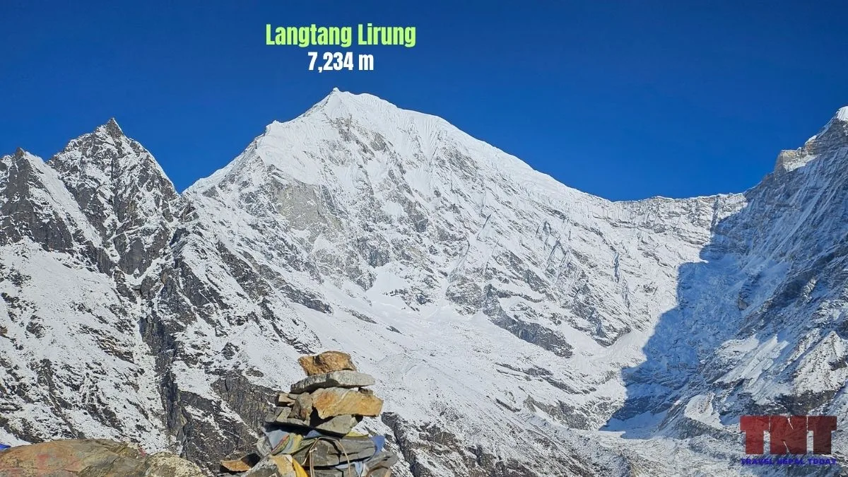
Langtang Lirung is 7,234 m (23,734 ft). Other sources may claim 7,227 m, 7,245 m, or 7,246 m. These differences come from different survey and map editions.
The mountain is better known for its relief than its absolute height. It rises about 5,500 m above the Bhotekoshi-Trisuli River to the west in only 16 km.
Langtang Village sits at 3,455 m, and the summit is only 4.5 km away. That is a rise of nearly 3,800 m over a short horizontal distance!
The peak sits on the main Himalayan watershed. The Lhende Khola valley drains the north side toward the Bhote Koshi, while the Langtang Valley drains the south side, and both rivers feed the Bhotekoshi-Trishuli system. Within about 4 km lie Ghenye Liru (6,571 m) to the west and Kimshung or Tsangbu R (6,781 m) to the east.
Name, Discovery and Local Meaning
No record names a single person who “named” Langtang Lirung. The mountain takes its name from the place, and Langtang is the older name.
A widely repeated story says a lama following a runaway yak found the valley, with lang meaning yak and a second syllable meaning “to follow.” Another variant shows connection with Guru Rinpoche arriving in the form of a bull.
Both are legends, not documented history. What we can say is that the peak got its name from the locality, rather than the other way around!
The people of Langtang have their own relationship with the mountain. In fact, the Langtangpa regard Langtang Lirung as their yu-lha, the local country god.
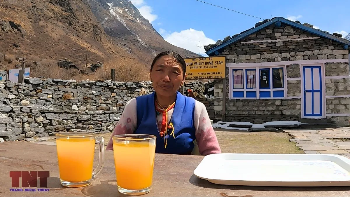
The Langtangpa speak a Tibetan language closely related to that of Kyirong in southern Tibet, although the national census classifies them as “Tamang“.
On “discovery,” the honest answer is that local people have always known the mountain.
The first documented outside reconnaissance came in 1949, when Bill Tilman and Peter Lloyd explored the region. Tilman went up the Lirung Glacier with Tenzing Sherpa but reached only a subsidiary ridge.
The two climbers then tried to approach from the north along the Tibetan border, got lost, and accidentally crossed into Tibet before an official sent them back!
First Ascent and Climbing History
Conquering Langtang Lirung has historically challenged the world’s finest mountaineers due to its extreme steepness and relentless avalanche risks.
Despite these formidable obstacles, a few determined expeditions have successfully carved their names into its climbing history.
The First Ascent of Langtang Lirung (1978)
Langtang Lirung was first climbed on October 24, 1978. The American Alpine Journal report describes a joint Nepalese-Japanese expedition led by Akira Ban, made up of four Nepalese from Tribhuvan University and nine Japanese from Osaka City University.
The team followed the East Ridge from the Lirung Glacier. Seishi Wada of Japan and Pemba Tshering reached the summit.
The team set Camp 2 at 5,710 m on October 15, Camp 3 at 6,280 m four days later, and Camp 4 at 6,800 m on October 22. Wada reached the top at 9:25 am, and Pemba Tshering followed two minutes later.
The Himalayan Database record of the expedition confirms the route as the Lirung Glacier to East Ridge line. Several earlier attempts had failed, and some had even ended in deaths!
Timeline of Notable Attempts and Ascents
| Year | Event |
|---|---|
| 1949 | Tilman, Lloyd and Tenzing Sherpa make the first documented reconnaissance. |
| 1961 | An Osaka City University team led by Kaichi Morimoto is hit by an avalanche on the east ridge at 6,450 m. Three die! |
| 1963 | An Italian team led by Lino Andreotti is hit by avalanches on the east ridge. Two die! |
| 1964 | A Japanese team tries the south ridge, and a British-Australian team abandons the southwest ridge at 6,700 m. |
| 1978 | First ascent by Wada and Pemba Tsering |
| 1980 | A British-Canadian team reaches 5,600 m on the south face before retreating. |
| 1985 | Three members of an American team, including its leader Daniel Newell, die in an avalanche on the northeast buttress. |
| 1988 | First winter ascent on January 3 by Mikołaj Czyżewski, Kazimierz Kiszka and Adam Potoczek. |
| 1990 | An avalanche kills three members of a Japanese team on the southeast ridge. |
| 2009 | Slovenian climber Tomaž Humar dies during a solo attempt on the south face. |
| 2010 | An Iranian team led by Arash Ghiasian climbs the south face. |
| 2024 | Holeček and Húserka make the first ascent of the east face. Húserka dies on the descent. |
How Often Has Langtang Lirung Been Climbed?
Rarely!
Across 15 successful teams, 55 climbers have stood on top, and 17 people have died. Avalanches and catastrophic glacial collapses remain the leading causes of death on the mountain, a danger highlighted as recently as August 2026 when a massive ice-and-rock avalanche sheared off the peak!
No team has ever used bottled oxygen during a successful climb. Prior to the historic autumn 2024 East Face alpine-style ascent, the mountain had gone completely unclimbed for 14 years, with the previous success dating all the way back to 2010!
The Faces and Ridges of Langtang Lirung
Langtang Lirung is a large massif with steep sides in every direction. It does not have a single “front.” What follows is a face-by-face summary based on climbing records and research.
South and Southeast: the Langtang Valley side
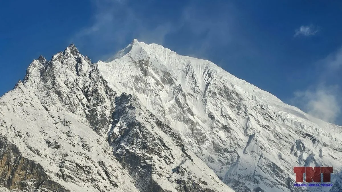
The south side looks over the Langtang Valley and the Lirung Glacier. The glacier descends from the southeast face.
The south face has few recorded attempts, one of which was the 1980 route along snow and ice gullies, a rib and rock buttresses, with a steep ice arête above leading to a summit about 900 m higher. Avalanches were a constant threat.
The face killed Tomaž Humar in 2009, and the Iranian team’s climb in 2010 is the only recorded success!
The southeast and southwest ridges are the most common routes. Most of the successful ascents before 2024 used one of these ridges.
East: The Largest Wall
The east face is the most formidable side at more than 2,200 m high. From above Kyanjin Gompa, the northeast ridge appears on the right and the southeast ridge on the left.
The 1978 first ascent took the East Ridge, but the face itself was untouched for decades.
Several teams turned back. A Japanese team in 2010 reached only 4,150 m. Paraglider-alpinists Antoine Girard and Julien Dusserre flew toward it in 2017 and abandoned the attempt.
In 2022, three Ecuadorian climbers gave up at 5,800 m because of rockfall. Holeček and Húserka finally succeeded in October 2024!
North: The Border Face
The north face drops toward the Lhende Khola, the river that flows to the Gyirong (Kyirong) border region with Tibet.
Few climbers have gone there! An American team tried the northeast buttress in 1984 and again in 1985, and three members died in the second attempt.
This is also the side that failed on August 26, 2026. According to ICIMOD, the collapse detached from the northern face and plunged into the Lhende Khola valley. The source zone sat at roughly 5,200 m!
West and Southwest: Toward the Trisuli Gandaki
The west side falls toward the Trisuli Gandaki valley, with Ghenye Liru standing between the two.
The southwest ridge was tried in 1964 by the British-Australian team that retreated at 6,700 m. It later became one of the two most common routes.
Best Places to See Langtang Lirung?
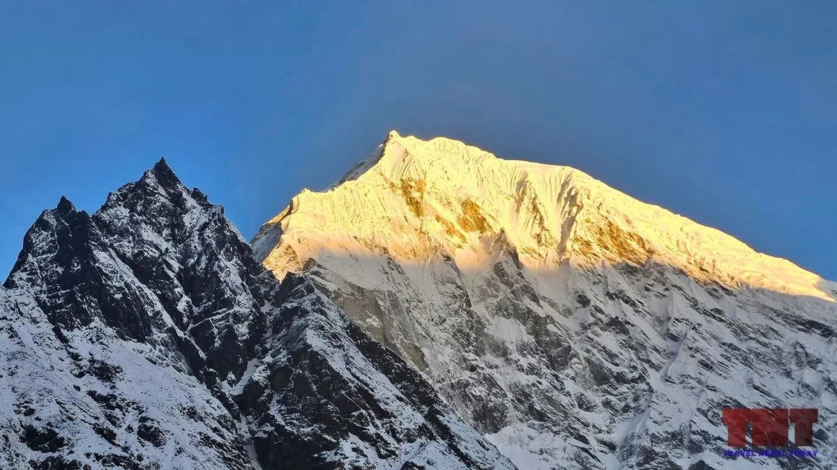
The classic view is from the upper Langtang Valley. You get clear views of the mountain from above Kyanjin Gompa (the south face).
The best-known hill viewpoints near Kyanjin Gompa are Lower Kyanjin Ri (4,300 m), Kyanjin Ri (4,700 m) and Tsergo Ri (4,985 m). Tsergo Ri is higher and gives a wider panorama of the Langtang and Jugal Himal range!
The peak is also visible from far away! It forms a clean snow pyramid when seen from the south, including from the Kathmandu Valley on a clear day!
The Lirung Glacier
The Lirung Glacier is the best-studied ice body on the mountain. It is small, but few glaciers in the Himalaya have been measured as closely!
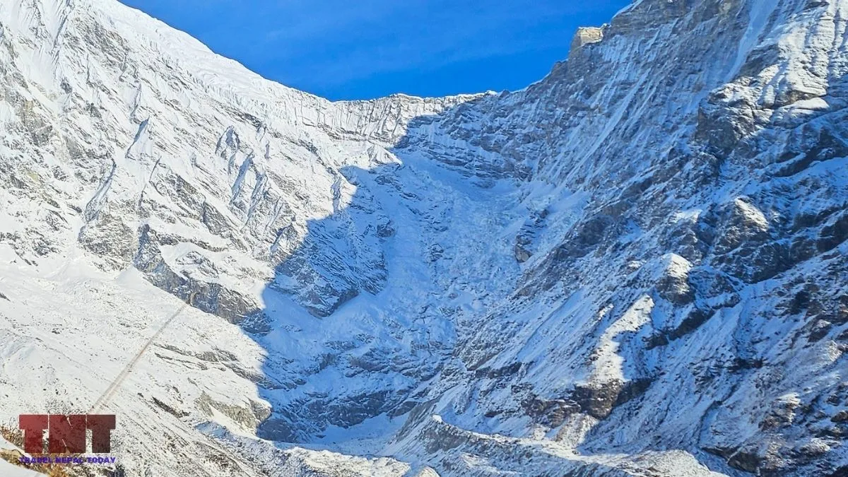
Size and Structure
Lirung Glacier covers about 6.1 km² and descends from the southeast face. Its lower part is a debris-covered ablation zone, meaning the melting zone is buried under rock.
One study describes a 4 km debris-covered tongue that passes beneath a steep bare rock slope at about 4,400 to 4,600 m. Reportedly, debris on most of the glacier is thicker than 60 cm.
What Research Has Found
Ongoing scientific monitoring and glaciological studies offer a closer look at the physical changes happening across the massif. These findings help researchers better understand glacier behavior and environmental shifts in the Langtang region:
- Thinning: A study of the glacier’s debris-covered area found its surface lowered by 1.3 to 1.8 m per year between 1974 and 2010, with thinning accelerating after 2000.
- Ponds and cliffs. Miles and colleagues measured the water levels of supraglacial ponds in 2013 and 2014 and found that ponds link surface and internal drainage. A catchment-wide study found that ice cliffs added about 17% to ice loss on debris-covered tongues that scientists would otherwise have underestimated.
- Monitoring network. Researchers have worked with ICIMOD and partners to maintain a weather network in the valley, which makes Langtang Lirung one of the better-documented debris-covered glaciers anywhere.
Lirung Glacier is not the glacier that collapsed: This is a common mix-up. The 2026 collapse happened on an unnamed glacier on the north side of the mountain. Lirung Glacier lies on the south and southeast side, in a different drainage.
Lirung Glacial Lake
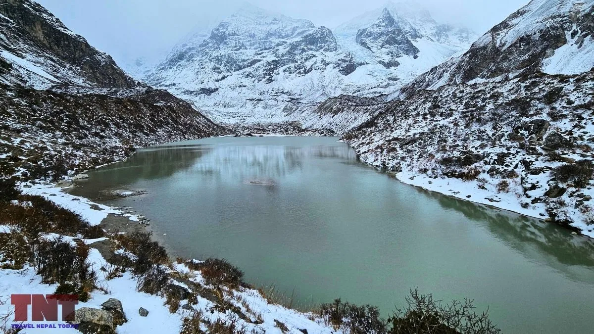
At the snout of Lirung Glacier sits Lirung Glacial Lake, which locals call Kyanjing Lake. It is a proglacial lake (a lake that forms in front of a glacier), fed by the melting ice of Lirung Glacier, and it lies at about 3,960 m approx. (above Kyanjin Gompa).
This lake also does real work! After the 2015 disaster, a micro-hydro plant was built at its moraine, and its 100 kW now powers Kyanjin and Langtang villages. Drawing water from the lake also helps keep its level down.
The 2015 Avalanche Above Langtang Village
The mountain had already caused one major disaster.
On April 25, 2015, the Gorkha earthquake triggered avalanches and rockfalls that destroyed Langtang village.
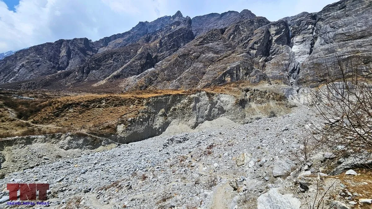
A peer-reviewed study by Fujita and colleagues found the main event was an avalanche composed mostly of snow, not mainly glacier ice, and that unusually heavy winter snowfall may have amplified the disaster.
Counts of the dead differ by source, from about 240 in the village to more than 350 across the valley. The village was rebuilt, and new lodges had opened by 2017!
August 26, 2026: The North-Flank Collapse
At 8:37 am Nepal time, a mass of rock and glacier ice detached from the north flank of Langtang Lirung and fell into the Lhende Khola valley.
ICIMOD’s synthesis report says the debris reached the border corridor in about 7 minutes. SMS alerts went out at about 9:15 to 9:16 am, around 25 to 30 minutes after the corridor had been hit.
Did Langtang Lirung Cause the Bhotekoshi Flood?
Yes, ICIMOD’s synthesis concludes that a bedrock failure on the north face sheared away part of an overlying glacier, starting a chain of hazards involving rock, ice, water and sediment.
It describes the event as not a conventional glacial lake outburst flood, which was the first assumption. Britannica’s entry describes the same sequence and notes the fall of about 1,200 m into the Lende Khola.
The Warning Signs in the Satellite Record
ICIMOD’s report found that Sentinel-1 radar satellite data showed up to 40 cm of line-of-sight ground deformation at the source between July 7 and August 24, 2026.
This suggests the slope was moving for about 48 days before failure. The researchers caution that the movement could not have predicted exactly when the collapse would occur, but they say satellite monitoring may help flag other unstable slopes.
The Human and Economic Toll
According to the National Disaster Risk Reduction and Management Authority, quoted by ICIMOD, at least 1,451 people were killed and 5,745 remain missing in Nepal, while Chinese authorities reported 43 deaths and 519 missing.
Britannica reports about 7,500 homes were destroyed and some 20,000 damaged, with Nepali authorities estimating an economic cost of USD 4 billion to 7 billion. In early October, Nepal’s government announced it would end search and rescue operations!
The flood destroyed the Gyirong border port and the Rasuwagadhi crossing. It then moved down the Bhote Koshi and Trishuli rivers. The flood gauges bolted to bridges on the Trishuli were working, but the flood took away the instruments with the bridges!
Clearly, we saw that warning systems built around rainfall and river levels are not designed to detect sudden mountain collapses!
Climate Change and Its Effects in Langtang Lirung
Climate is part of the story, but it is not the whole story!
A World Weather Attribution analysis concluded that human-caused warming thinned glaciers and thawed permafrost, likely helping to destabilize the slope.
The report cautioned that climate change was not the only cause, that damage from the 2015 earthquake may have weakened the rock, and that it could not determine whether the collapse would have happened without climate change.
Moreover, local temperatures in August 2026 were about 5°C above normal, with 1.5°C of that attributed to climate change. The analysis also pointed to unusually heavy snowfall in October and November 2025, which added meltwater once temperatures rose.
Reportedly, the Langtang Lirung glacier has retreated about half a kilometer since the 1990s!
ICIMOD takes a more cautious line. Its synthesis lists geological weaknesses, damage from the 2015 earthquake, thawing permafrost, glacier change and gradual snow and ice accumulation as possible contributors, and says no single trigger has been confirmed.
Geology also matters! The rapid uplift along the Greater Himalaya, combined with deep river cutting along both flanks of the mountain, creates oversteepened slopes.
The same river corridor also flooded in July 2025, when a draining supraglacial lake caused a destructive flood. These two events were two catastrophic disasters in 13 months, caused by different mechanisms.
Langtang Lirung Climbing Permit, Royalty and Costs
Langtang Lirung is an expedition peak. Permits for peaks above the Nepal Mountaineering Association list are issued by the Department of Tourism, and the application goes through a registered trekking agency.
Official Royalty for Foreign Climbers
The Department of Tourism’s fee page lists royalties effective September 1, 2025. Langtang Lirung, at 7,234 m, falls in the 7,001 to 7,500 m category. Here are the cost details:
| Season | Royalty per foreign climber (USD) |
|---|---|
| Spring | 800 |
| Autumn | 400 |
| Winter or summer | 200 |
Nepali climbers are required to pay NPR 30,000 in spring, NPR 15,000 in autumn and NPR 7,500 in winter or summer for the same category.
Garbage Management Deposit
The higher rates apply to named mountains in the Khumbu and Annapurna ranges. For other Himalayan ranges, a peak below 8,000 m carries a deposit of USD 500.
Langtang Lirung is a part of the Langtang Himal Range, and is not in the Khumbu or Annapurna ranges, so USD 500 appears to be the applicable figure.
However, please note that the prices can change in the future. So, we recommend checking the Department of Tourism or directly with the agency you’re planning to apply from.
Other Costs and Requirements
Beyond official climbing royalties, organizing an expedition involves several mandatory national park fees and regulatory compliances. Here are a few you should know about:
- Langtang National Park entry: The current fee is NPR 3,000 for non-SAARC visitors, NPR 1500 for SAARC nationals, and NPR 100 for Nepalese.
- Insurance: Under the proposed Integrated Tourism Bill, a trekking agency managing an expedition must obtain insurance covering accident, medical treatment, search and rescue, and body management for climbers, liaison officers, sirdars, guides, and support staff.
- Health certificates: The same bill would require a recent health certificate for every team member. The National Assembly passed the bill in February 2026, so consider this like mandatory.
- Liaison officer, logistics, and permits. These costs vary by operator.
There is no official all-in price for a Langtang Lirung expedition, and published operator prices vary widely. Do not rely on a single quoted total. Compare different prices, but above all, choose a company with a good reputation and experience because a mountain like Langtang Lirung, which only a few attempt to climb, is a real challenge!
Season Definitions and Royalty Refunds
As per traditional trekking season, Spring is generally March to May, autumn is September to November, and winter and summer cover the remaining months.
But we’ve already explained why September is no longer the right time to trek, which is the same for expeditions. However, operation-wise, agencies still prioritize the month for expeditions (so, it remains unchanged). If you want the safe side, we recommend October as it’s more stable in terms of weather, but cold starts to creep in.
If an expedition is abandoned or the permit revoked, the proposed bill says royalty is not refunded. It allows adjustment against a later permit within two years if a natural disaster prevents the expedition.
Visiting the Langtang region After the Flood?
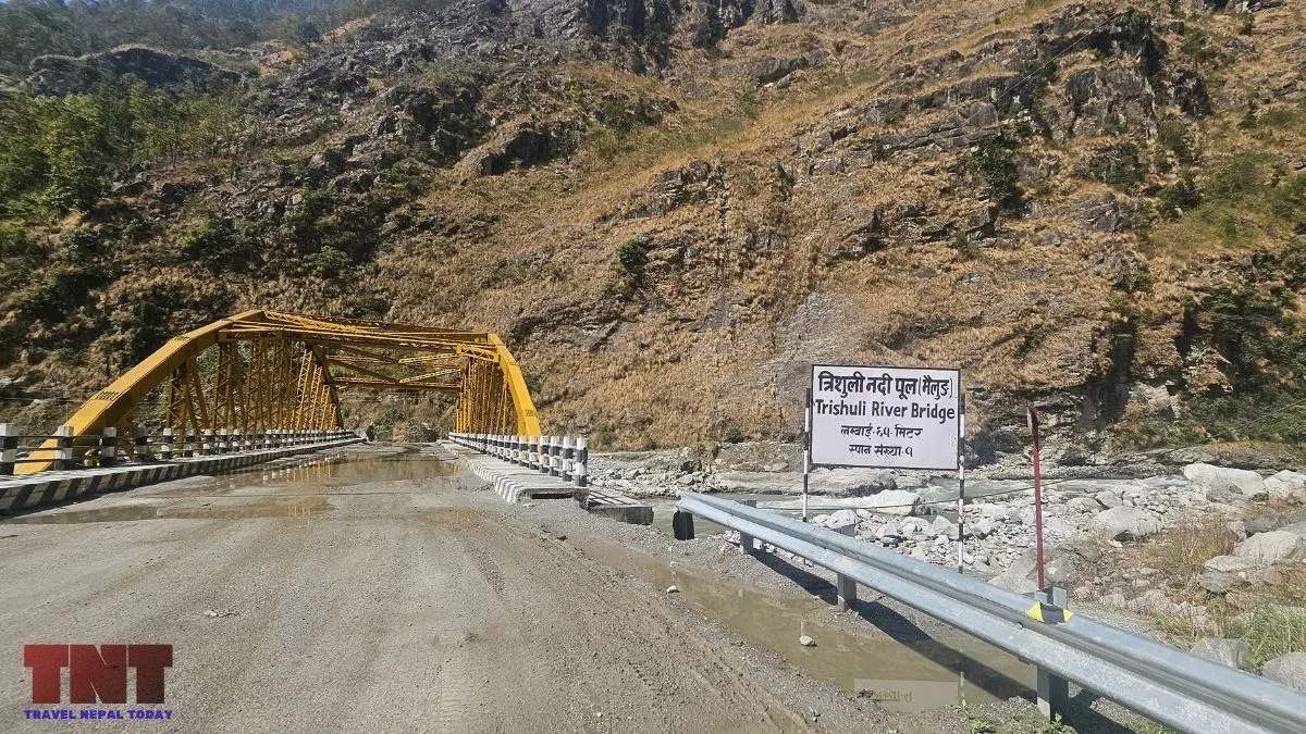
The collapse and flood did not travel down the main Langtang trekking valley. The debris bypassed the Langtang trekking valley and tore through the corridor between Kyirong and Rasuwa.
The damage that affects travelers is on the roadside. Syaphru Bensi, the usual trailhead, was heavily hit, and the approach roads were disrupted!
Access is changing. Dhunche is now being used as an alternative route for light vehicles. After getting to Dhunche, you’ll walk along the Gosaikunda Trail and reach Thulo Syaphru as an alternative way into the valley, as Syaphru Bensi is being repaired.
Final Thoughts
Langtang Lirung is a 7,234 m peak that has been climbed only a handful of times, partly because avalanches threaten every face and ridge.
Its south side feeds the heavily studied Lirung Glacier, and its north side produced the 2026 collapse. Both facts trace back to the same setting: a very steep mountain on the Himalayan watershed, with rivers cutting deeply on both sides!
The 2026 research is still preliminary. Volumes, speeds, and causes may be revised, so check for updates before relying on any single figure!
About The Author