Key Takeaways:
- Machhapuchhre, or Mount Fishtail, is a 6,993 m Annapurna Himal peak that remains closed to climbers.
- Its shape shifts by angle, from a sharp triangle at Pokhara to an unfamiliar back view at base camp.
- Sarangkot, 11 km from Pokhara, is the shortest sunrise spot, reachable by drive or cable car.
- Mardi Himal Base Camp, at 4,500 m, sits directly beneath the peak with close southwest views.
- The ABC route rotates the view from south to northwest, and Machhapuchhre Base Camp is only a stop.
- On the Machhapuchre Model Trek, Khumai Danda, a grassy 3,245 m ridge, sits at the foot of the south face.
- Poon Hill, Mohare Danda and Kokhe Danda show it as one peak in a long skyline.
- Some Gurung and Hindu communities revere it, but Harka Gurung said locals call all snow peaks “kling”.
- No verified ascent exists, and the 1957 British attempt turned back roughly 40 to 50 m below the top.
- The closure has cultural, technical, and political explanations, but none fully settles why it stays closed.
- Machhapuchhre’s own ice is mostly steep hanging glaciers, while the big Sanctuary glaciers belong to its neighbours.
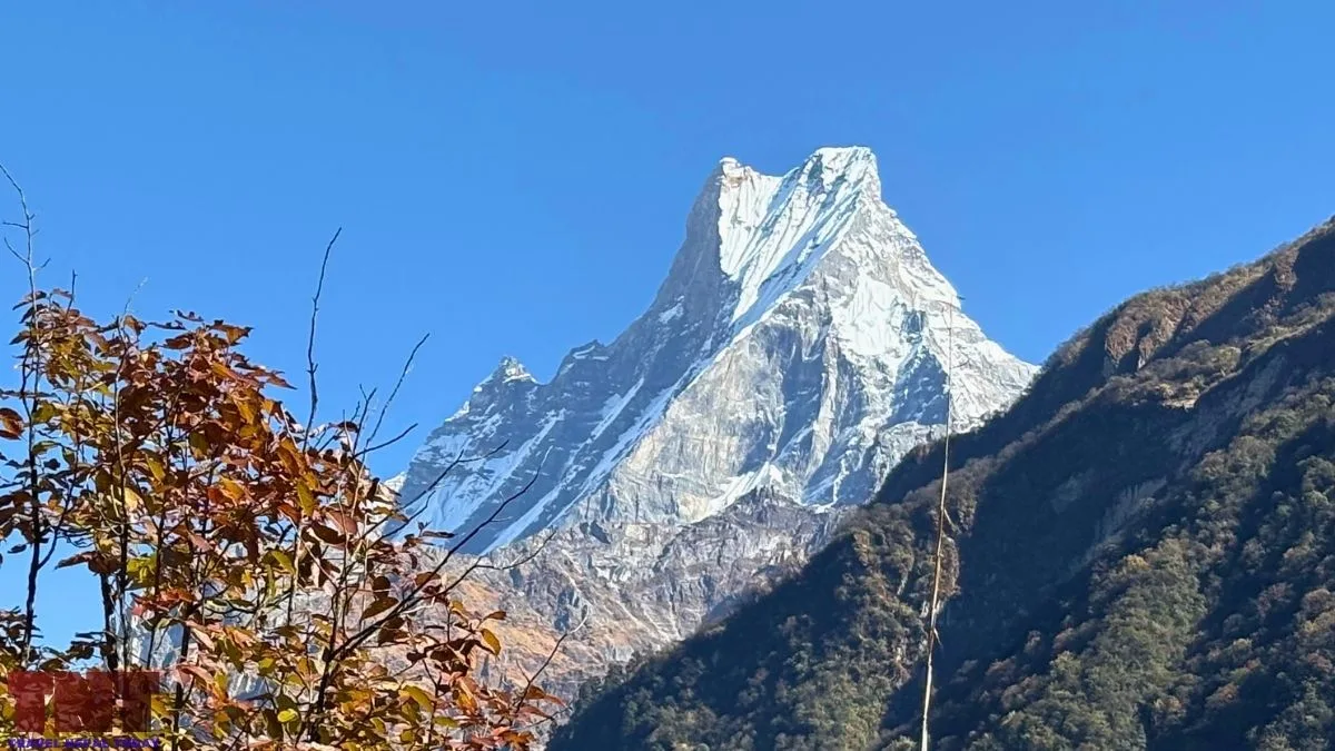
Machhapuchhre or Machapuchare (also called Mount Fishtail in English) is a 6,993 m peak in the Annapurna Himal of Gandaki Province.
It is shorter than its neighbours Annapurna I (8,091 m) and Annapurna III (7,555 m), yet it is the peak closest to Pokhara, and the one most visitors recognize!
Interestingly, Machhapuchhre is closed to climbing, and no one has verifiably stood on its summit.
Those two facts, a mountain everyone sees and a mountain no one climbs, produce a lot of repeated stories. Some are well documented. Others, especially about why it is closed, rest on very little.
This article separates the two as it goes through the mountain’s shape, the trails that give the best views, its sacred associations, the 1957 summit attempt, the closure, and what recent winters say about its melting snow. Let’s get started, shall we?
Machhapuchhre Quick Facts
| Name Meaning | From Nepali: machha (fish) and puchhre (tailed), after its two summit points |
| Gurung name | Katasunkli |
| Height | 6,993 m (22,943 ft) |
| Coordinates | 28°29′42″N 83°56′57″E |
| Location | Machhapuchhre Rural Municipality, Kaski District, Gandaki Province |
| Climbing status | Restricted and unclimbed |
| Closest recorded attempt | 2 June 1957, roughly 40 to 50 m below the top (sources differ) |
| Trekking viewpoints | Pokhara, Mardi Himal ridge, Khumai and Korchan Danda, Machhapuchhre Model Trek, Annapurna Base Camp Trek (base camp located here) |
Where is Machhapuchhre and How High is It?
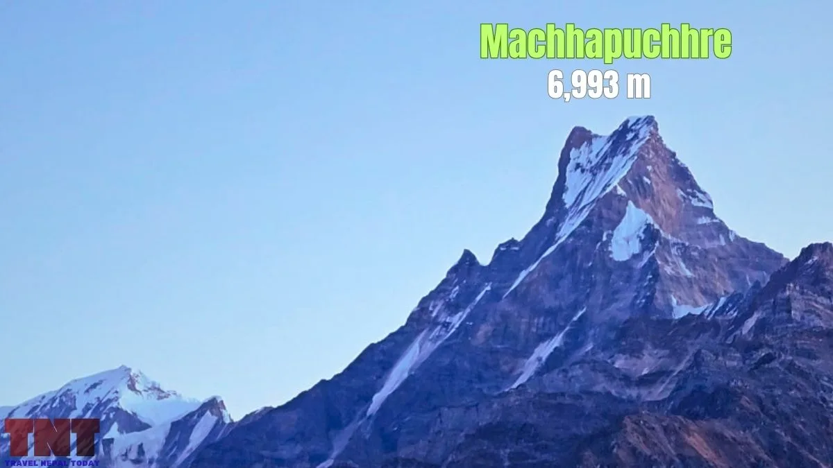
Machhapuchhre stands at the southern end of a spur that runs off the Annapurna backbone. It forms the eastern edge of the Annapurna Sanctuary, the glacial basin that trekkers enter on the Annapurna Base Camp (ABC) route.
The height most commonly used is 6,993 m. Some older maps may give 6,997 m, though.
The height tells you less than the relief does! Pokhara Airport sits at 827 m. Subtracting that from 6,993 m gives about 6,166 m of vertical rise, over a horizontal distance of roughly 25 km.
This is a simple calculation, not a survey result. This is just to tell you why the mountain looks so steep and so close from the valley floor.
Why Does Machhapuchhre Look Different From Every Side?
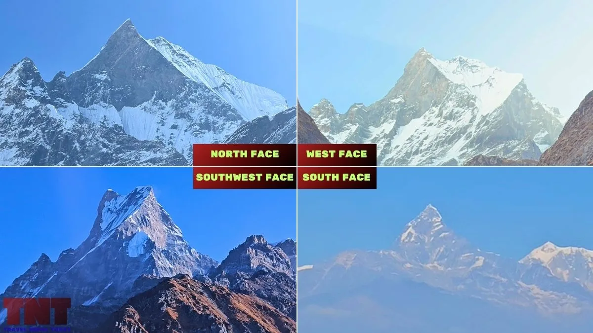
The mountain changes shape with the viewing angle, and accounts disagree on the details:
- A sharp triangular summit from Pokhara
- A solid pyramid from the east
- A snow and ice mass with a clearer double summit from the north
- A steep rock and snow pyramid from the Mardi Himal trek.
If you want to check this for yourself, we advise looking from more than one place and at more than one time of day, because light and cloud change how much of the split you see!
| Viewpoint | Which face is seen? | What the mountain looks like |
|---|---|---|
| Pokhara Valley, Sarangkot | South and southwest | Sharp triangular peak rising over the valley. |
| Mardi Himal West Route (popular one) | South and southwest | Very steep rock and snow pyramid, close and large. |
| Poon Hill, Mohare Danda, and Kokhe Danda | Southwest | Part of a grand, panoramic horizon sweep. |
| Khumai Danda, Mardi Himal South Base Camp Route (and most parts of Machhapuchhre Model Trek) | South | Peak at the centre of the Annapurna skyline, with Mardi Himal on its left. |
| Annapurna Base Camp (lower routes: Ghandruk to Dovan) | South, southwest, and west | A changing profile that transitions and brings you very close to the two peaks. |
| Machhapuchhre Base Camp and ABC (Annapurna Sanctuary) | Northwest (often considered North Face) | The triangular back view of Machhapuchhre is seen (very different from its common appearance from Pokhara or Ghandruk; many may find it hard to recognize). |
From Pokhara and Nearby Viewpoints
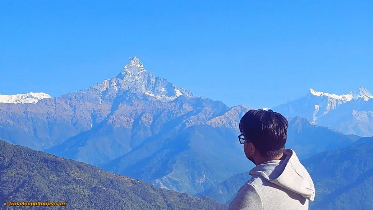
Pokhara is the easiest place to see the mountain. In fact, the peak is the closest to the city, and even offers great views of the neighboring Annapurna South, Hiunchuli, Mardi Himal, Annapurna IV, Annapurna II, and other peaks of Annapurna Himal.
Sarangkot, a hill about 11 km from the city at roughly 1,600 m, is the standard sunrise point, and Machhapuchhre is of course among the best peaks seen from here! Sunrise is the best time to be there, so be sure you spend a night there or opt for a morning visit (via drive or cable car).
Beyond Sarangkot, places like Dhampus, Kahundanda, the World Peace Pagoda, Pumdikot, Thulakot, Tiger Top, and almost every other hilltop offer the same south face view of the mountain.
From the Mardi Himal Trek
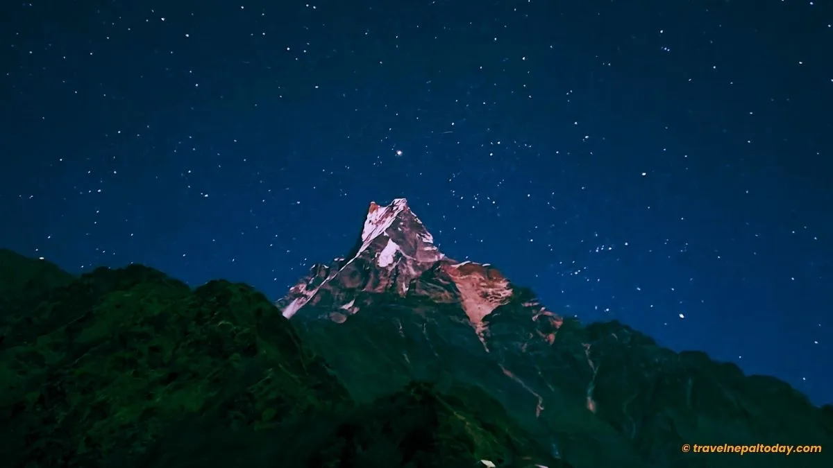
The popular Mardi Himal trek (western route) follows a high ridge southwest of the mountain. There also exists another less common route beyond Khumai Danda (the southern trail) that offers an even closer south view of Machhapuchhre.
The trek takes its name from Mardi Himal, a 5,587 m trekking peak first climbed in 1961. Machhapuchhre is separated from it by a high col at about 5,200 m and stands roughly 1,400 m above it!
That height difference explains why the trek is remembered for Machhapuchhre, not for its namesake.
Mardi Himal Base Camp, at about 4,500 m, sits directly beneath Machhapuchhre, with Annapurna South and Hiunchuli also dominant peaks visible from up there.
The major stops along the route are Dhampus, Australian Camp, Pittam Deurali (common starting point where transportation reaches), Forest Camp, Low Camp, Badal Danda and High Camp, then a pre-sunrise climb to the Upper Viewpoint. You can see Machhapuchre from all these spots: first the south face, then the southwest face as you go higher.
You might like reading: Bhishu’s 5 Days Mardi Himal Trek with Tips
From Annapurna Base Camp Trek
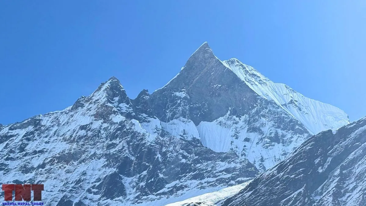
On the ABC route, trekkers walk into the Annapurna Sanctuary along the Modi Khola gorge and see the mountain from the south, southwest, west, and northwest (northern side).
Just like the Mardi Himal Trek, you’d start with its south and southwest views from Ghandruk to Dovan. Then, after crossing Deurali, you come face to face with the direct west face of the mountain. And as you climb higher towards Machhapuchhre Base Camp, the northern face (particularly the northwest) comes into view.
The name causes slight confusion among trekkers. It is a stop, not a climbing base camp!
The Annapurna Sanctuary (Annapurna Base Camp) lies northwest of the peak, so the setting sun falls on the face you are looking at. The sunset is incredible and indeed one of the best highlights of the classic ABC trek.
From Khumai Danda and Other Sections of Machhapuchhre Model Trek
Khumai Danda sits right at the base of the south face of Machhapuchhre. It is a grassy ridge at 3,245 m, above the tree line, and the high point of the Machhapuchhre Model Trek.
Col. Jimmy Roberts once called this side of the mountain “the other sanctuary”!
Here’s the thing, though: you are on the same line of sight as the Pokhara viewpoints, so the mountain never shows its two summit points. It just gets bigger and closer.
The classic version of the trek starts at the Mardi riverside at about 1,120 m and passes Ribhan, the only village on the way. The first camp is near the Odane viewpoint (2,513 m), the second is at Khumai, and a day trip from there goes up to Korchon at about 3,680.
A shorter 3-day version is also walked. You drive from Pokhara to Hemja and hike to Hile Kharka (2,160 m) via Ghachowk. The next day you sleep at Khumai Danda, then climb Korchan (about 3,700 m, sources round it differently) and come down to Ghachowk.
From Poon Hill, Mohare Danda, Kokhe Danda, and Nearby Viewpoints
On the western side, Machhapuchhre is one peak in a long line, not the centrepiece. Dhaulagiri and the Annapurna giants dominate, and the Fishtail sits toward the eastern end of the skyline, after Annapurna South and Hiunchuli.
So, if the Fishtail is your main reason for the trip, we would pick Khumai Danda or Mardi Himal instead. But if you want a wide sunrise that includes it, this side works very well!
Mohare Danda (about 3,313 m) is in Myagdi, a short hike beyond Poon Hill. It is run as a community eco-lodge trail, so it is quieter, with the same Dhaulagiri, Annapurna South and Machhapuchhre sweep.
Kokhe Danda (3,309 m) is another half hour past Mohare Danda, in Parbat district. It stands higher than Poon Hill and looks across Parbat, Kaski, Syangja, Baglung, Myagdi, Lamjung and Tanahun.
If you want to go further, the Khopra side adds Muldai (about 3,640 m) and Khopra Ridge (about 3,640 m).
For the Fishtail, Kori Danda at about 3,800 m shows it alongside Annapurna II, Annapurna IV, Lamjung Himal and Mt. Manaslu. As with every viewpoint on this list, go at sunrise and carry a warm layer.
Is Machhapuchhre a Sacred Mountain?
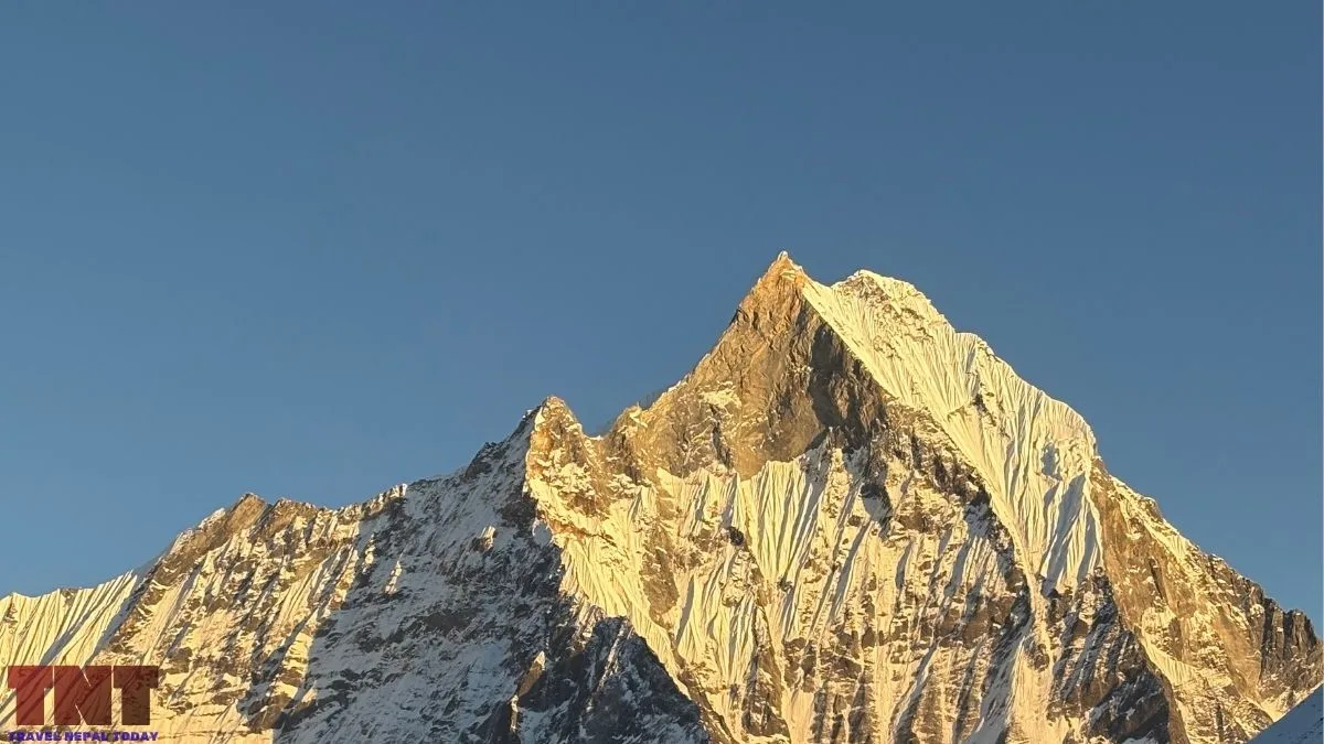
For some communities, it is! But the evidence is mixed, and it is worth being careful about who says what.
Reportedly, Gurung communities call the mountain Katasunkli and regard it as a mountain god. Moreover, some Hindu communities see the twin summits as the sages Nara and Narayana (considered incarnations of Lord Vishnu). Some also consider it an abode of Lord Shiva and his consort, Parbati.
However, according to the Late Geographer Harka Gurung, instead of being a sacred mountain, local people there call all snow peaks “kling“, their word for snow.
Basically, whether the mountain is sacred is subjective: some do, while others are not sure.
The 1957 team met the belief directly. Noyce had written that villagers at Ghandruk feared the party might offend local gods by entering the Sanctuary, which was guarded by a small shrine, and also mentioned in his accounts that the team had agreed to “keep on the right side of the gods“.
Has Anyone Climbed Machhapuchhre?
Officially, no!
The peak remains unclimbed with two recorded expeditions, both British: a 1956 reconnaissance and the 1957 attempt.
| Year | Event |
|---|---|
| 1950 | Jimmy Roberts photographs the mountain from the north during Bill Tilman‘s Annapurna IV expedition. Charles Wylie later recalled thinking it “quite impossible” (per the Himalayan Journal) |
| 1956 | Roberts reconnoitres the Modi Khola basin and identifies one feasible route |
| 24 April 1957 | Base camp reached in falling snow |
| 2 June 1957 | Noyce and David Cox turn back below the summit |
| Early 1980s (disputed) | Unverified claim that New Zealander Bill Denz climbed it secretly |
The 1957 Attempt in Detail
The expedition was led by Roberts, with Wilfrid Noyce, David Cox, Charles Wylie and Roger Chorley, plus some Sherpa staff.
Chorley developed polio early on and left. The route followed the north ridge to the northeast face, per the Himalayan Database expedition record.
Noyce’s Alpine Journal account describes the summit day:
- He and Cox left at 4:15 a.m. in deep snow.
- By about 11 a.m., with snow falling andcloudsd building, four polished ice ribs still stood between them and the top, and cutting steps was slow.
- They stopped just below the summit, buried a Nepalese flag and a Union Jack, drove in a piton and turned back.
- They were back at their tent at 2:30 p.m., after about ten and a quarter hours.
How far below the top is the mystery! Different sources give about 40 m, 45 m, 46 m and 50 m. We can say that they stopped “just 40m short” because of impassable ice pinnacles and an approaching storm.
Why is Machhapuchhre Closed to Climbers Today?
There are three possible explanations:
- Religious or cultural: This is the explanation most often given, and the section on sacred beliefs above covers the evidence for and against it. However, critics point out that other mountains regarded as holy, such as Gauri Shankar, are open to climbing!
- Technical: The 1957 team found the final section hard, but experienced climbers reached to within about 50 m, so difficulty alone does not explain a closure. The mountain is steep and avalanche-prone, but Nepal opens many difficult peaks!
- Political or administrative: Roberts, then at the British Embassy in Kathmandu, reportedly convinced the royal government to keep the mountain out of bounds. Some accused him of acting out of pique!
Even though Nepal keeps opening new peaks to expeditions, Machhapuchhre has not been listed even until today!
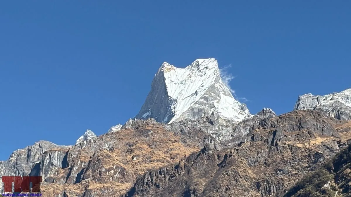
There have been repeated attempts to change this locally.
- The municipality passed a resolution in 2017 asking for the ban to be lifted, and the council elected in 2022 was also in support of its opening.
- In 2018, there was another proposal to open it but was opposed by Pokhara culture experts. A Great Machhapuchhre Trail, scouted by teams from the Nepal Tourism Board and the Nepal Mountaineering Association, was proposed as an alternative!
- No recorded proposals have been recorded after that.
Our views on this are in favor of the 2018 rejection. Machhapuchre is indeed too beautiful to be climbed. There are plenty of other peaks that remain open for expedition that mountaineers can choose from.
That doesn’t mean we aren’t promoting mountain climbing in Nepal. In fact, we definitely do! Just leaving the most loved mountain of Pokhara out of this :).
Glaciers of the Fishtail Mountain
Machhapuchhre’s own ice is mostly steep hanging glaciers on its upper faces. The big glaciers you walk beside in the Sanctuary belong to its neighbours.
A geological guide to the Himalaya published by Oxford University Press describes hanging glaciers on the mountain running down toward the Seti Khola!
The 1957 team met them from above. Also, Noyce and Cox abseiled onto a hanging glacier on their way up the north ridge.
Final Words
Machhapuchhre looks different from every side, so pick the viewpoint that fits the time and legs you have, not the one with the most photos online.
Sarangkot can just be a short morning visit. Khumai Danda or the Mardi Himal ridge gives you 3 to 5 days and a close south face.
Poon Hill, Mohare Danda and Kokhe Danda give you a wide skyline with the Fishtail in it. The Annapurna Base Camp Trek gives you the north side.
Happy travelling!
About The Author