Key Takeaways:
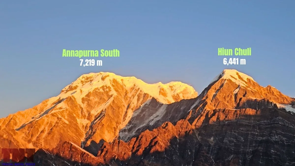
- Annapurna South is a 7,219 m peak in the Annapurna Himal, Gandaki Province. It forms the southwestern corner of the Annapurna Sanctuary’s rim. Hiun Chuli (6,441 m) extends from it!
- A Kyoto University Alpine Club team made the first ascent on October 15, 1964. Shoichiro Uyeo and Mingma Tsering Sherpa reached the highest, southern summit at around 12:30 pm.
- The mountain is rarely climbed, with only 36 expeditions known so far, and the latest team in 2015 had to turn back at 6,000 m because of rockfall.
- The classic trekker views are from Ghandruk, Poon Hill, Mardi Himal and Annapurna Base Camp areas. You’ll even get a clear view of this mountain from Pokhara!
- Glaciers in the Annapurna Himal lost 6.07% of their area on average between 2000 and 2014/15. Among them, the South Annapurna Glacier tongue is also thinning!
- Avalanches from Annapurna South and Hiunchuli reach the trail near Deurali (Hinku Cave area).
- Foreign climbers need to pay a royalty of USD 800 (spring), USD 400 (autumn), USD 200 (winter and summer) for its expedition. A USD 2,000 garbage deposit also applies!
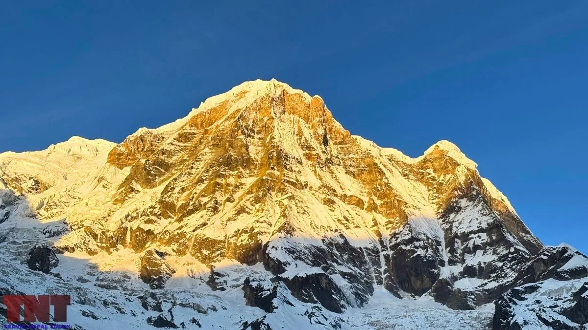
Annapurna South is the big mountain that stands right in front of you during the upper sections of the Annapurna Base Camp trek.
It is a 7,219 m peak on the southwestern rim of the Annapurna Sanctuary, and many trekkers take it for Annapurna I. It is not!
Annapurna I is the 8,091 m mountain that gives the range its name. It stands further north, at the head of the Sanctuary. You get a proper look at it only after you cross Machhapuchre Base Camp (on the way to ABC).
Annapurna South and Hiun Chuli sit right beside it and are visible much earlier! That is why they get mistaken for the main peak.
This article covers the height and names, the 1964 first ascent and later climbs, the faces and routes, the best viewpoints, the glaciers, climate change, the avalanche hazard on the trail, and the 2026 permit costs. Let’s get started!
Key Facts About Annapurna South
| Location | Annapurna Rural Municipalities in both Kaski and Myagdi Districts, Gandaki Province |
| Height | 7,219 m (23,684 ft) |
| Coordinates | 28°31’05.7″N 83°48’21.1″E |
| Other names | Annapurna Dakshin, Moditse, Modi Peak |
| Summits | North top (about 7,100 m), Central top (about 7,150 m), highest southern summit (7,219 m) |
| First Ascent | October 15, 1964, Shoichiro Uyeo and Mingma Tsering Sherpa |
| First Ascent of the Central Top | October 13, 1964, Hiromichi Yoshino, Masaaki Kimura and Yutaka Ageta |
| First Winter-season Ascent | December 17, 1994, five Russians, central spur of the south face |
| Expeditions on record | 35 |
| Main Glacier | South Annapurna Glacier |
| Foreign Royalty (7,001 to 7,500 m category) | USD 800 spring, USD 400 autumn, USD 200 winter/summer |
| Garbage Deposit | USD 2,000 (Annapurna range, 7,001 to 8,000 m) |
Annapurna South Height, Location and Summits
Annapurna South is 7,219 m (23,684 ft) high. The mountain stands in Gandaki Province right at the border of the Kaski and Myagdi sides, in their respective Annapurna Rural Municipalities. Yes, there are two rural municipalities with the same name!
It lies inside the Annapurna Conservation Area, which covers 7,629 km².
A British Mountaineering Council report places its eastern pillar at the southwest corner of the Annapurna Sanctuary. The Sanctuary’s only entrance is a narrow valley between Hiun Chuli and Machhapuchhre.
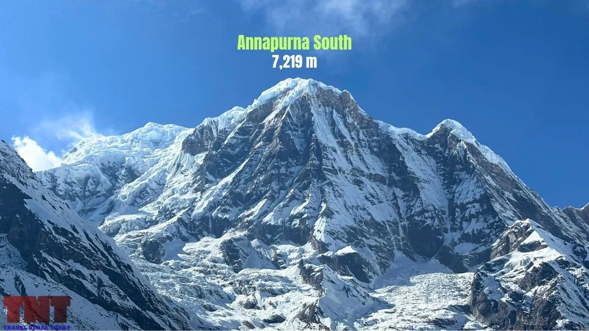
Annapurna South is not a single point. The 1964 Japanese team from the Kyoto University Alpine Club found a north top, a central top, and a southern top.
Among them, the southern one was the highest! It was a narrow, snow-covered point where two climbers could not stand at the same time.
Later expedition notes describe the area between the tops as a broad snow plateau, a huge flat snowfield about 2 miles long!
Note: Hiun Chuli (6,441 m) is a satellite peak extending from Annapurna South. It was first climbed in 1971. On the trail, it guards the entrance to the Sanctuary, opposite Machhapuchhre.
Different Names: Annapurna, Dakshin, Moditse and “Ganesh”
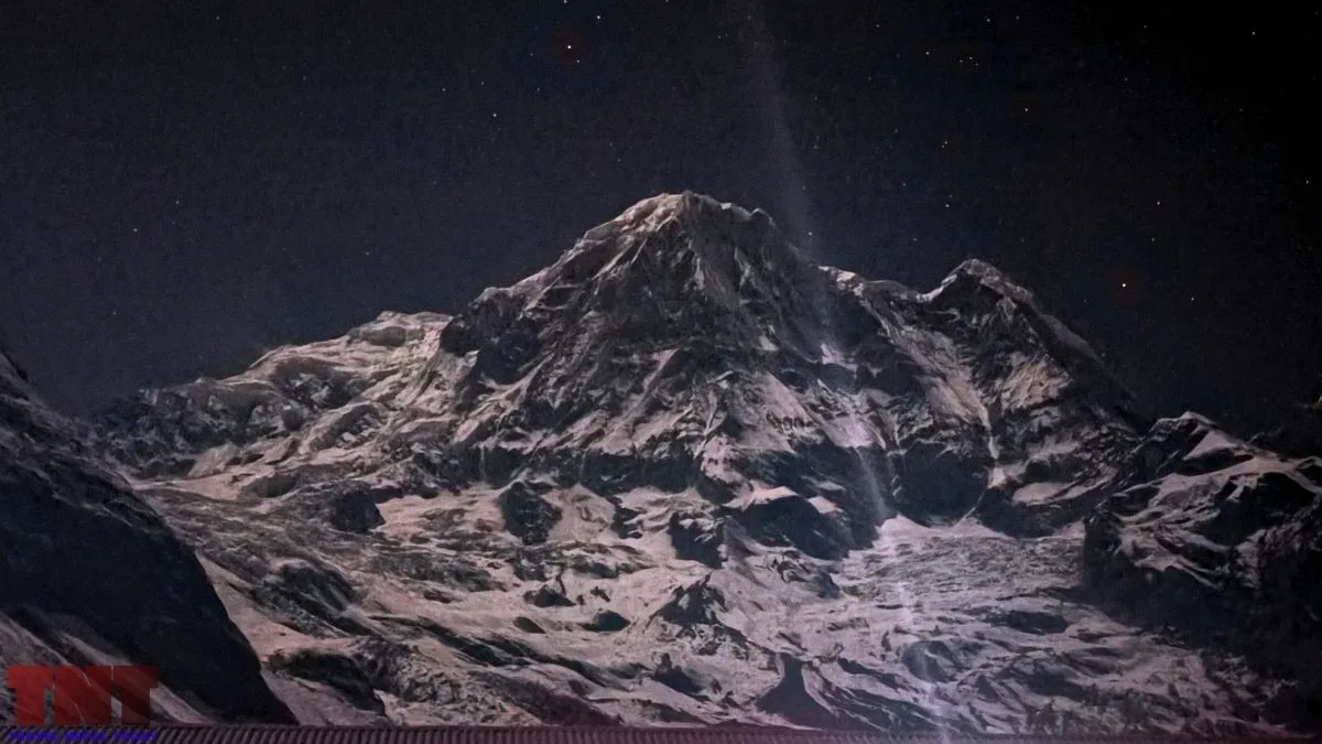
Annapurna is Sanskrit. Anna means food or grain and purna means full or complete. The Hindu goddess Annapurna is the goddess of food and nourishment, and the massif is believed to be named after her!
Dakshin means south in Nepali, so Annapurna Dakshin is simply Annapurna South.
Other names for the mountain are Moditse and Modi Peak. Both tie the mountain to the Modi Khola valley below it.
The 1964 Japanese team called the mountain Ganesh in its report. It noted that Dr. Toni Hagen’s book already used “Annapurna South Peak” as the official name. The team also wrote that people in Ghandruk used a local name, spelled in the report as Daulasiri.
Do not confuse “Ganesh” here with Ganesh Himal, which is a different mountain range.
Who Climbed Annapurna South First?
Shoichiro Uyeo and Mingma Tsering Sherpa reached the highest summit of Annapurna South on October 15, 1964 at around 12:30 pm.
They were members of a Kyoto University Alpine Club expedition. The details below come from Uyeo’s own account in the 1965 Alpine Journal.
How the 1964 Expedition Happened?
The club first wanted to summit Dhaulagiri IV. Nepal had already given permission for that peak to a British party, so the Kyoto team switched to Annapurna South.
In 1957, two members of the British Machhapuchhre expedition had looked at the peak from the east and reached about 5,940 m (19,500 ft), reporting that it looked possible!
The team had six members: leader Dr. Haruo Higuchi (35), Shoichiro Uyeo (26), Hiromichi Yoshino (23), Kiyoo Shimada (22), Masaaki Kimura (21) and Yutaka Ageta (20).
Sherpas, a liaison officer, and 54 porters supported them. They left Pokhara on September 9 and set up base camp on September 15 at 4,000 m, in the ablation valley of the South Annapurna Glacier.
The Route and the Camps
The team could not use the ridge from the col between Annapurna South and Hiunchuli. They used an ice and snow ridge they called the Serac Ridge, which rises from the foot of the east face.
| Camp | Height | Date |
| Camp I | 4,600 m | Sept 21 |
| Camp II | 5,200 m | Sept 27 |
| Camp III | 5,600 m | Oct 1-3 |
| Camp IV | 6,200 m | Oct 6 |
| Camp V | 6,600 m | Oct 12 |
Below Camp IV, an overhanging ice wall 8 to 20 m high forced a day and a half of climbing, and the team fixed an improvised ladder of rope and firewood.
Early in the climb, three members barely escaped a debris slide from a hanging glacier on the east face. A large serac collapse also threatened Camp III.
Summit Days
On October 13, Yoshino, Kimura and Ageta reached the central top at 3:40 pm. They saw that the north and south tops were slightly higher, but there was no time to continue.
On October 15, Uyeo and Mingma Tsering crossed the central top and reached the southernmost top at 12:30 pm. Higuchi and a Sherpa named Karma went north and reached a minor point on the way to the north top. They were turned back by poor conditions and lack of time.
The team was back in Pokhara on November 3, after also climbing the 5,945 m Tent Peak.
Climbing History: Ascents and Attempts
Annapurna South has never drawn crowds. A British Mountaineering Council report said that by spring 2009, 10 expeditions had reached the main summit, and more than half of them used south-face routes from outside the Sanctuary.
| Year | Event |
| 1957 | Two members of the British Machhapuchhre expedition scout the peak from the east, reaching about 5,940 m. |
| 1964 | First ascent by Uyeo and Mingma Tsering Sherpa. The central top was climbed two days earlier. |
| 1970 | French climbers Gérard Devouassoux and Maurice Gicquel reach the summit from the south on October 27, with one bivouac above their high camp. |
| 1972 | A Japanese team climbs the east ridge to the central top. |
| 1974 | A Japanese team tries the southwest ridge. Avalanches from the south ridge destroy six base camp tents and injure the liaison officer along with a Sherpa. |
| 1978 | A Japanese team using the southwest ridge and south face puts four climbers on the summit on October 16. |
| 1987 | A Japanese winter attempt switches to the southwest ridge after a hanging-glacier collapse on the south face. It does not summit. |
| 1988 | A small American team reaches 6,100 m on the central spur of the south face. |
| 1991 | A Japanese team puts three climbers on top via the southwest ridge. |
| 1994 | Five Russians climb the central spur of the south face, reaching the summit on December 17. They used no Sherpas, fixed camps, fixed ropes or oxygen. |
| 2009 | Slovak climber Dodo Kopold solos the 2,200 m east pillar in about 40 hours, then reaches the main summit. |
| 2010 | Two French climbers summit via the east ridge on October 8. |
| 2015 | A French team on the east ridge turns back at 6,000 m because of dangerous rockfall. |
Kopold’s East Pillar
Kopold’s route topped out on a north summit at about 7,100 m that the BMC described as previously unvisited.
He then crossed to the 7,219 m main summit and descended the original Japanese route. The date of the climb was somewhere between April 10 and 11, 2009.
Faces and Routes of Annapurna South
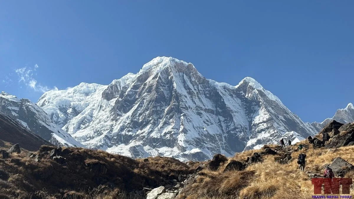
The mountain has been attempted from every side. Here is what the records show:
| Face or Ridge | What is known |
| East face and Serac Ridge | The 1964 first-ascent line, exposed to ice avalanches and serac fall. Japanese teams repeated variations in the 1970s. |
| East ridge | Reached the central top in 1972 and the main summit in 2010. The 2015 attempt was abandoned at 6,000 m in rockfall. |
| East pillar | Soloed by Kopold in 2009, rated VI/6 and M5 by him, about 2,200 m high. |
| South face and central spur | Climbed by the French in 1970 and the Russians in 1994. Teams here camp on the Kyumrun (Khyumu) side, not inside the Sanctuary. |
| Southwest ridge | Climbed in 1978 and 1991. Several other teams stopped between 5,650 m and 6,300 m. |
| West face | Attempted by a Polish team in 1979. I could not confirm the outcome. |
The south side is reached from Chhomrong by the Kyumrun valley. The 1974 Japanese team set base camp on the Kyumrun glacier at 4,200 m, close to the French camp of 1970.
Best Viewpoints
Annapurna South is easy to see. The harder part is knowing which mountain you are looking at!
It looks very massive from Ghandruk and can even be seen well from Pokhara, along with surrounding areas! Of course, the best view comes at Annapurna Base Camp!
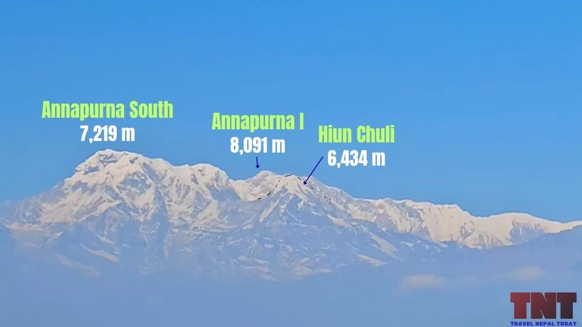
Here are the places where you get proper views of Annapurna South:
| Place | Approx. height | What you see |
| Pokhara | 800 m approx. | Annapurna South rising behind the lower hills on clear mornings. |
| Ghandruk | 2,000 m | Annapurna South, Hiun Chuli, Gangapurna and Machhapuchhre, with Annapurna South at the far left. |
| Chhomrong | 2,170 m | The most direct frontal view from a village, with Annapurna South and Hiunchuli above the Modi Khola. |
| Poon Hill, Mohare Danda, and Kokhe Danda | 3,210 m, 3,313 m, and 3,309 m | The south face of Annapurna South, in the classic sunrise panorama. |
| Mardi Himal Route | From Dhampus and Australian Camp onwards (as low as 1,500 m) | The east face can be seen from different points. |
| Annapurna Base Camp Route | From Ghandruk onwards (prominently from base camp at 4,130 m) | The closest view, with Annapurna South and Hiunchuli forming the southwestern wall. |
Note: Annapurna South is not visible from the general North ABC trekking route (Maurice Herzog trail). It gets blocked by Annapurna I when you’re at Panchakunda Lake or the base camp.
Glaciers Around Annapurna South
The glaciers around Annapurna South are less studied than those near Everest or Langtang range, but three are very well named in expedition and research records.
South Annapurna Glacier
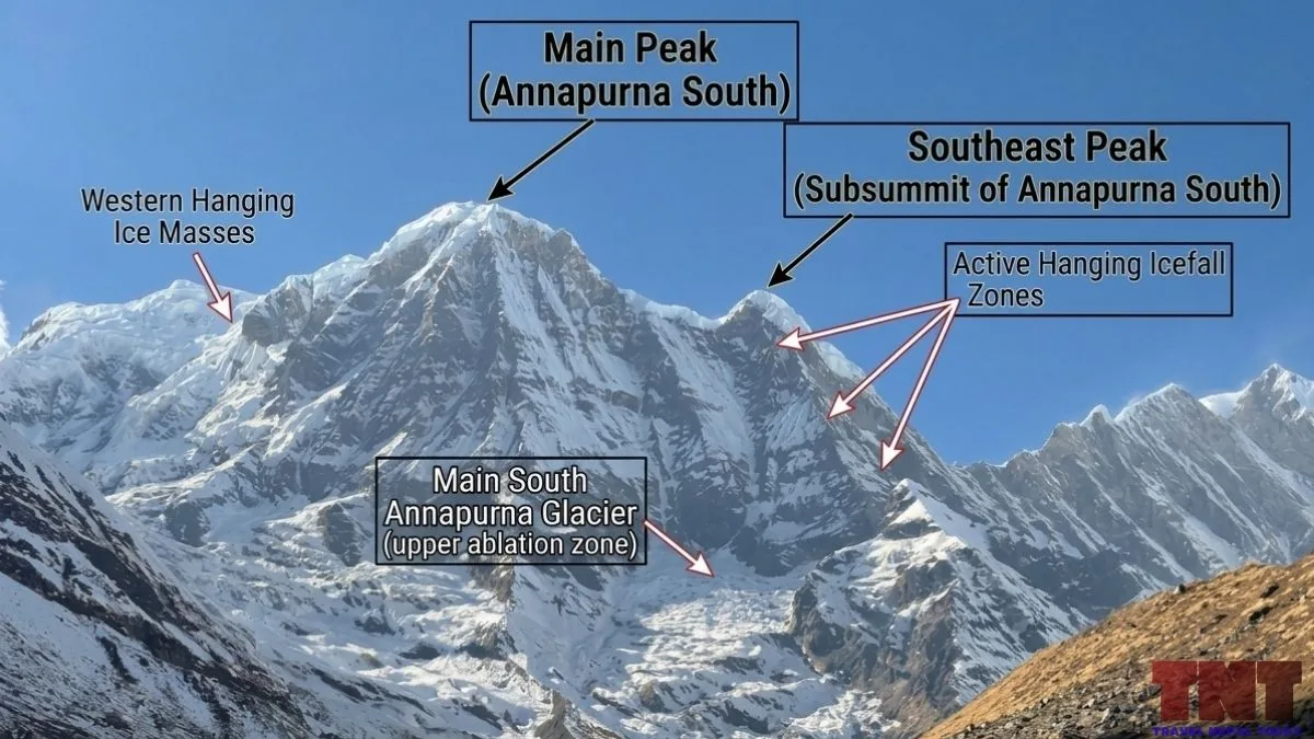
This is one of the main glaciers of the Annapurna region. The 1964 team had placed base camp in its ablation valley at 4,000 m! The ablation zone is the lower part where the ice melts.
Research papers call it the Annapurna South Glacier. It is the one trekkers walk beside near Annapurna Base Camp.
A 2019 study in Remote Sensing by Lovell, Carr, and Stokes found clear surface lowering on its ablation zone.
Ganesh Glacier and the Hanging Ice on the East Face
The 1964 team named the glacier running from the col between Annapurna South and Hiun Chuli the “Ganesh Glacier”.
They placed Camp I on its moraine at 4,600 m. Above it, hanging glaciers on the east face dropped debris across their approach, and a serac collapse threatened Camp III.
Note: “Ganesh Glacier” is the expedition’s name, so modern maps may label it differently!
Kyumrun (Khyumu) Glacier
This glacier lies on the south side and feeds the Kyumrun Khola. The 1974 Japanese and 1987 French and Japanese teams camped here!
In 1987, another Japanese team saw the top of a hanging glacier break off on the south face and had to change their route.
What the Research Says?
The best-quality data is the 2019 study of 162 glaciers in the Annapurna Conservation Area. These are its main findings:
- Area loss: total glacier area fell by about 8.5% between 2000 and 2014/15, from almost 500 km².
- Annapurna Range: mean area loss was 6.07%. That is smaller than in the Muktinath Himal (11.89%) and Damodar Himal (11.15%). The authors think the larger Annapurna Himal glaciers respond more slowly.
- Thinning: mean surface lowering was 0.33 m a year for 72 glaciers (2000 to 2013/16). Only three of those were in the Annapurna Himal, so this figure may not represent the area around Annapurna South.
- No region-wide stagnation: many glacier tongues still moved more than 10 m a year. Speeds of 50 to over 100 m a year were measured in the Annapurna Himal.
Avalanches and Safety on the Trekking Trail
Annapurna South might be admirable from the trail, but it also sends snow down it!
Reportedly, the spots near Deurali (particularly near Hinku Cave) are exposed to avalanches coming off the flanks of Hiun Chuli and Annapurna South, funneling snow and ice blocks onto the path.
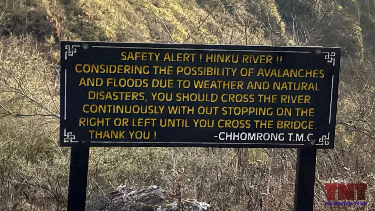
Recent incidents on the Annapurna Base Camp trail are:
- January 2020: an avalanche hit the Hinku Cave and Deurali section, sweeping away four South Korean trekkers and three Nepali guides. Hinku Cave is at about 3,200 m. Bodies of two of the missing were found about three and a half months later.
- March 2025: a Chinese trekker returning from Annapurna Base Camp was found dead near Deurali after an avalanche.
You see, experiencing snow in ABC might be a major attraction but can also be dangerous!
So, we suggest asking your lodge or the ACAP checkpoint at Birethanti or Chhomrong about trail status. Remember not to cross avalanche tracks after fresh snowfall or in poor weather.
Climbing Permits, Royalty and Costs for Annapurna South
Annapurna South is an expedition peak, not a trekking peak. Climbing permits are issued by the Department of Tourism through a registered trekking agency, as for other expedition peaks.
Royalty for Foreign Climbers
The Department of Tourism’s mountaineering fee page lists royalties effective September 1, 2025. At 7,219 m, Annapurna South falls in the 7,001 to 7,500 m category. So, the fees to climb this mountain are:
| Season | Royalty per foreign climber (USD) |
| Spring | 800 |
| Autumn | 400 |
| Winter or summer | 200 |
Nepali climbers need to pay NPR 30,000 in spring, NPR 15,000 in autumn, and NPR 7,500 in winter or summer for the same category.
Note: Spring is generally March to May and autumn September to November. Winter and summer cover the remaining months. However, due to climate change an season shiting, some months even during the peak season can be risky (like September which can be treated as monsoon).
Garbage Management Deposit
A deposit of USD 2,000 (or the NPR equivalent) is required for mountains of 7,001 to 8,000 m in the Khumbu and Annapurna ranges. Annapurna South is in the Annapurna Himal, so this appears to apply!
By comparison, a 7,000 m peak in another range, such as Langtang Lirung, falls under the USD 500 category.
The deposit is a security amount. It is returned only when the team brings its waste back and the officials accept it!
Entry Permits for the Approach
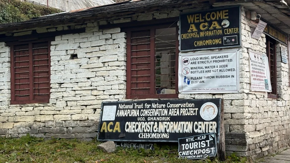
Everyone walking through the Annapurna Conservation Area needs an ACAP (Annapurna Conservation Area Permit) entry permit.
As of 2026, the fee goes like this: NPR 3,000 for foreigners and NPR 1,000 for SAARC nationals.
While some trekking agencies may report that TIMS card fees are required, it’s not the case anymore. The ACAP is the only permit required to enter the Annapurna region right now!
Beyond permits, an expedition also pays for agency services, a liaison officer, staff insurance, and logistics.
There is no official all-in price. So, you’ll have to compare the prices listed by operators carefully, and choose one with proven experience on technical peaks.
Final Thoughts
Annapurna South is one of the most photographed mountains in Nepal, but also one of the least climbed.
Its record is short, and it comes mostly from a handful of Japanese, French, Russian, and Slovak teams over six decades!
Trekkers should know that it is a separate mountain from Annapurna I, and that its slopes send avalanches onto the Himalaya-Deurali trail. So, you have to be very careful, whether you’re coming to Annapurna Sanctuary for trekking or an expedition!
About The Author