Key Takeaways:
- Ngadi Chuli is a 7,871 m mountain in Nepal’s Mansiri Himal, ranked 20th-highest on Earth and also called Peak 29.
- Ngadi Chuli means the peak above Ngadi, the home area of geographer Dr. Harka Gurung, who helped name Himalayan peaks.
- It sits between Manaslu and Himalchuli in the Manaslu Conservation Area, on the Gorkha and Manang border.
- Taller neighbours, no standard climbing route, and a hidden west face keep Ngadi Chuli out of most Manaslu trekkers’ attention.
- Ten recorded expeditions between 1961 and 1982 produced one confirmed summit in 1979 and one unproven Japanese claim from 1970.
- No standard route exists, only a short list of east, west, south-west and south-east lines that expeditions have tried.
- Shyala, Pungen Gumba and Samagaun offer views on the Manaslu Circuit, but it disappears after Samagaun.
- Foreign climbers need to pay US$1,000 in spring, US$500 in autumn and US$250 in winter and monsoon, through a registered company.
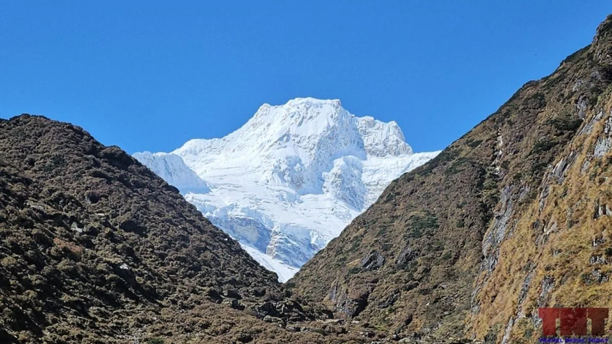
Ngadi Chuli is a 7,871 m mountain in the Mansiri Himal of central Nepal. It stands between Manaslu to the north and Himalchuli to the south east.
It is commonly ranked as the 20th-highest mountain on Earth, and mountaineers have long called it Peak 29!
Mount Manaslu is only 292 m higher and draws almost all the attention. The mountain’s climbing story is just as unusual. One Japanese pair may have reached the summit in 1970, but both died on the way down and nobody could prove it!
The first confirmed ascent came in 1979. However, there has been no other attempt since 1982!
This article explains what the mountain is called and why, how its height and rank are measured, and what is known about its climbing history. It also covers where trekkers report seeing it, what its glaciers are doing, and what a climbing permit costs today.
Key Facts About Ngadi Chuli
| Other names | Peak 29, Dr Harka Gurung Chuli, Dakura |
| Height | 7,871 m (25,823 ft) |
| World Rank | 20th-highest mountain on Earth |
| Coordinates | 28°30’12″N 84°34’07″E |
| Range | Mansiri Himal (Manaslu Himal) |
| Location | Chumnubri Rural Municipality, Gorkha District (bordering Manang), Gandaki Province |
| First confirmed ascent | 8 May 1979, Ryszard Gajewski and Maciej Pawlikowski (Poland), west spur |
| Disputed earlier claim | 19 October 1970, Hiroshi Watanabe and Lhakpa Tsering (Japan), both died on the descent |
| Last recorded attempt | 1982 (British Army expedition), in the sources I could access |
| Climbing royalty (foreign climbers, 7,501 to 7,999 m class) | US$1,000 spring, US$500 autumn, US$250 winter and monsoon |
Different Names of Ngadi Chuli and The Reasons Behind the Naming
The mountain has more names than most Nepali peaks. Here are they and how their naming came from:
| Name | Where it comes from |
|---|---|
| Ngadi Chuli | Nepali name linked to Ngadi, the area where Dr. Harka Gurung grew up |
| Peak 29 | Numbered label used by expeditions and journals |
| Dr Harka Gurung Chuli | Name given in his memory after his death |
| Dakura | Used in the 1970 Alpine Journal for “Peak 29” |
“Chuli” is the Nepali word for a peak, so Ngadi Chuli simply means the peak above Ngadi.
The Ngadi name has a personal story. Dr. Harka Gurung was a geographer, a former minister, and a member of the committee that gave Nepali names to many unnamed Himalayan peaks.
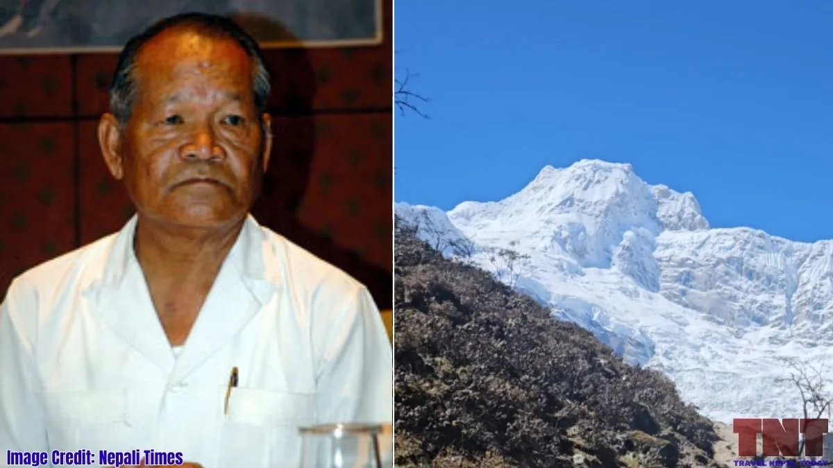
Peak 29, which towers over his home village, became Ngadi Chuli through his work! The American Association of Geographers says he led the government committee that named peaks in the late 1970s.
Harka Gurung was born in Lamjung in 1939. He died on 23 September 2006 in a helicopter crash in Taplejung, together with 23 others. The government later named the 7,871 m peak in his honour.
“Dunapurna” deserves a caution. An American Alpine Journal report on the 1979 climb carries “Peak 29 or Dunapurna” in its web address, so mountaineers were using the name by then. Some operators say local people use it and that it comes from Sanskrit words.
Where is Ngadi Chuli?
Ngadi Chuli lies in the Mansiri Himal, also called the Manaslu Himal. It is the middle and third-highest mountain of the massif, with Manaslu to the north and Himalchuli to the south east.
It lies in the border of Gorkha and Manang, with its peak within the Chumnubri Rural Municipality of Gorkha.
The mountain is within the Manaslu Conservation Area, which happens to be a restricted area.
The mountain has glaciers on both sides. The Alpine Journal reports that a 1969 Japanese team placed base camp near the south side of the Pungen glacier, which is on the Samagaun side.
The col between Ngadi Chuli and Manaslu is also documented. A Polish team on Manaslu in 1980 attempted the south ridge from the Pungen Glacier to a South Col at about 6,900 m.
Why Most People Miss It in Manaslu Trek?
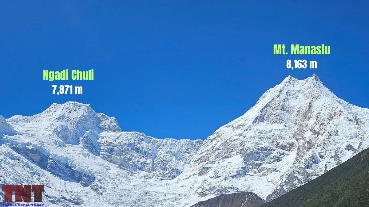
A few reasons stand out, and I want to separate documented ones from my own reading:
- Its neighbours are bigger. Manaslu is 8,163 m, and Himalchuli is 7,893 m. Ngadi Chuli sits between them.
- It has no standard climbing route. Operator pages offer expeditions, but the records show very few attempts!
- Its western side is hidden. The steep west face is recessed behind outlying peaks and glacial valleys.
Climbing History of Ngadi Chuli
There have been ten recorded expeditions so far, from 1961 to 1982:
| Year | What happened? |
|---|---|
| 1961 | Osaka reconnaissance from the west. |
| 1963 | Japanese attempt on the east ridge, post-monsoon. |
| 1969 | Osaka University expedition from the east. Highest camp 6,850 m on 24 October. Highest point about 7,400 m on 1 November, on the east ice wall. |
| 1970 | Japanese expedition on the east ridge claims the summit on 19 October. |
| 1970 | Dutch expedition on the south-east side, no result recorded. |
| 1974 and 1975 | Japanese attempts on the south-west face and east ridge, not successful. |
| 1978 | Japanese attempt on the south-west face. Three climbers die in an avalanche. |
| 1979 | Polish expedition climbs the west spur. Summit on 8 May. |
| 1982 | British Army expedition, south-east ridge, stopped by weather and logistics. |
The 1970 Question
On 19 October 1970, Hiroshi Watanabe and Sherpa Lhakpa Tsering left Camp V at about 7,500 m.
According to Günter Seyfferth’s research, teammates saw them about 70 m below the summit before they disappeared from view for nearly two hours.
On the descent, they fell down an ice wall from about 7,600 m, almost to Camp IV at 6,900 m. Their camera and Watanabe’s ice axe, which would have carried pennants, were never found.
So, nobody has conclusive proof that they reached the top. In fact, the Himalayan Database records the 1970 climb as “claimed”, with the 1979 climb as the first ascent. Japanese teams returned in 1974, 1975 and 1978 to settle the question, and none succeeded.
The honest statement is: 1970 is a probable but unproven ascent, and 1979 is the first confirmed one.
The 1979 Polish Ascent
A Polish team from Zakopane, led by Ryszard Szafirski, reached base camp on 6 April 1979.
Ryszard Gajewski and Maciej Pawlikowski summited on 8 May. The route was the west spur and the summit time was 15:27.
Reportedly, it was very difficult rock climbing around 5,600 m and about 3,000 m of west wall.
Since 1982
Günter Seyfferth’s 2014 summary, which is written in German, says no further attempts were made after the British expedition of 1982.
What the Records Say About Routes and Faces?
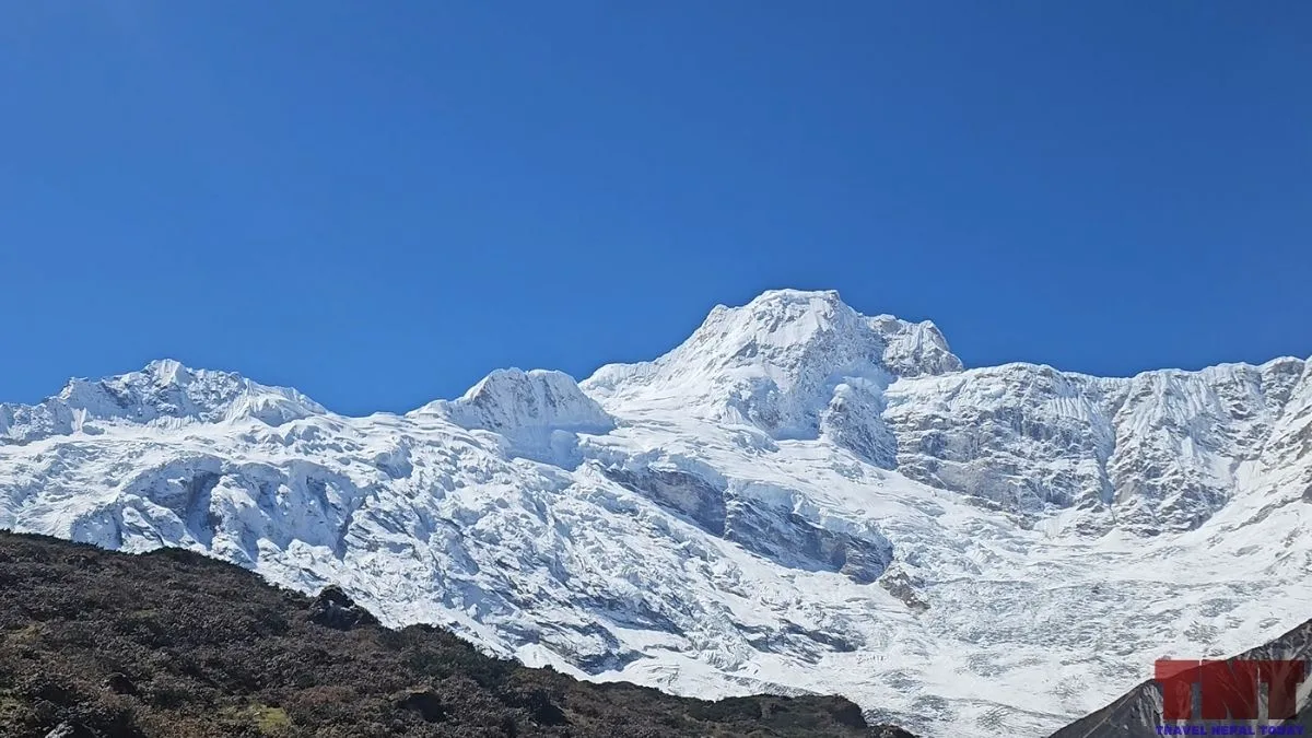
There is no standard route. What exists is a short list of lines that were tried:
- East ridge and east face: attempted by Japanese teams in 1963, 1969, 1970 and 1975. The 1970 claim used this side.
- West spur or buttress: the Polish route of 1979, the only confirmed ascent.
- South-west face: Japanese attempts in 1974 and 1978, with the three avalanche deaths in 1978.
- South-east side or ridge: the Dutch team of 1970 and the British team of 1982.
Where Can You See Ngadi Chuli?
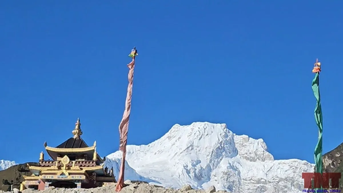
The Manaslu Circuit Trek is the best-known option where you get to see its east/north-east face. Let me list out the places where you get its view:
- Shyala offers direct views alongside the other peaks of the Mansiri Himal range.
- Pungen Gumba offers the best views when in clear weather.
- Visible from Samagaun too.
- Not visible after crossing Samagaun, so it’s not visible from Larke Pass either.
- Far-sighted views possible from Lamjung side (Ghale Gaun, Bhulbule, Usta, etc).
Clear weather matters more than the exact spot! Spring (March to May) and autumn (October to November) are the best seasons for the wider Manaslu region.
A practical tip: Look for the middle peak of a three-peak group, with Manaslu on one side and Himalchuli on the other. Confirm with your guide, because from some angles the peaks overlap.
Permits, Royalties and Rules
Climbing Ngadi Chuli needs a permit from Nepal’s Department of Tourism. Its within the 7,501 m – 7,999 m category, so based on that, here are the permit fees:
| Climber | Spring | Autumn | Winter and summer |
|---|---|---|---|
| Foreign climber (US dollars) | 1,000 | 500 | 250 |
| Nepali climber (rupees) | 40,000 | 20,000 | 10,000 |
Few Cautions:
- The Department’s garbage deposit schedule lists US$500 for mountains below 8,000 m outside the Khumbu and Annapurna ranges. Ngadi Chuli appears to fall in that group.
- The new rule against solo expeditions applies to peaks above 8,000 m, so it does not directly cover Ngadi Chuli. Yet, you shouldn’t go alone and must go through a registered mountainerring company.
Also, note that trekkers heading to the Manaslu region need separate entry permits, including a restricted area permit and a conservation area permit, which operators arrange. Moreover, a local municipality fee of NPR 1,000 also applies to foreign trekkers (and NPR 200 to Nepalese).
Final Words
Ngadi Chuli rewards a slow read. It is a high, serious mountain with a short and uncertain climbing record, named after a geographer and sitting beside better-known peaks.
Anyone planning a trip to Manaslu can look for it from the high valleys. Anyone interested in mountaineering history can follow the 1970 question and the 1979 ascent.
Continue reading the peaks of Nepal in Travel Nepal Today. We are on a mission to cover every single mountain of this beautiful country.
About The Author