Key Takeaways:
- Ganchenpo is a 6,378 m glaciated peak in Langtang National Park, Nepal.
- Its name likely comes from Tibetan phrase “gangs chen” (meaning great snow mountain or glacier); Tilman was the one who coined “Fluted Peak.”
- It stands in Rasuwa District, Langtang National Park, beside Urkenmang and Langshisa Ri.
- You can see it from Kyanjin Gompa, Tsergo Ri and Langshisha Kharka.
- Climbing routes include the fluted north-northwest face, south face, and several other ridges.
- The Bechs summited Ganchenpo without any permit in 1971, while the first permitted ascent came in 1990.
- Since this is an expedition peak, a guide is a compulsion. And you need to pay a royalty of USD 350 in spring or USD 175 in other seasons.
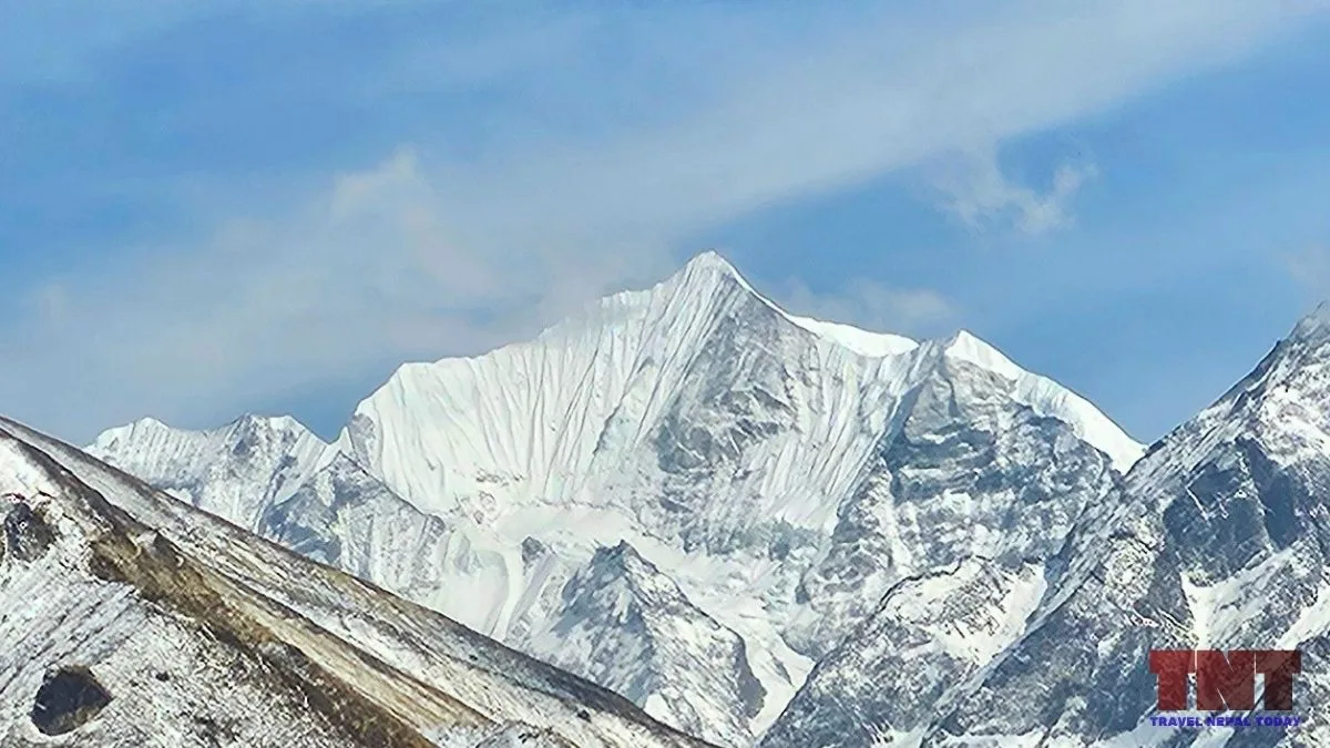
Ganchenpo, at 6,378 m, is a glaciated mountain at the head of the Langtang Valley in Nepal, known in English as the Fluted Peak and part of the Jugal Himal subrange of the central Himalayas.
It sits inside Langtang National Park in Rasuwa District, and rises roughly 2,380 m above the Langtang Valley in about 4 km. If you’re heading for the Langtang Valley Trek, you’ll see it past Langtang Village as you approach Kyanjin Gompa.
The record around this mountain is more tangled than its size suggests. The first known summit was reached without a permit in 1971, while the first recorded permitted ascent came in 1990.
Let’s learn everything about Ganchenpo together!
Key Facts About Ganchenpo
| Name and spellings | Ganchenpo, Gangchenpo, Ganchempo, Gangchempo, Gang Chhenpo, Fluted Peak |
| Height | 6,378 m (about 20,925 ft) |
| Location | Gosaikunda Rural Municipality, Rasuwa District, Bagmati Province |
| Coordinates | 28°10′08″N, 85°40′52″E |
| Range | Jugal Himal |
| First known summit | Late October / early November 1971, by Terry and Cherie Bech, without a permit |
| First recorded permitted ascent | 9 May 1990, Nepal Police expedition, south-west ridge |
| Permit status | Expedition Peak, not on the Nepal Mountaineering Association (NMA) trekking peak lists |
| Foreign climber royalty (per person) | USD 350 in spring, USD 175 in autumn, winter and summer |
What Does the Name Ganchenpo Mean?
Ganchenpo is an English spelling of a Tibetan-language name. Here, ‘gangs chen‘ means a great snow range or a great glacier (as per the Rangjung Yeshe dictionary).
Reading the mountain’s name as “great snow mountain” fits that meaning, but no published source explains the origin of this particular name, so it’s just our interpretation.
The English name comes from Bill Tilman, who explored the Langtang region in 1949. The Alpine Journal later referred to the peak as Tilman’s “Fluted Peak”.
A ‘flute’ here means a long vertical groove, and according to Angela Benavides from ExplorersWeb, the name is given because of its icy, fluted north face.
Note: Fluted Peak is not a unique name. Singu Chuli in the Annapurna region is also called Fluted Peak. So, it’s better we call it “Ganchenpo”!
How High is Ganchenpo?
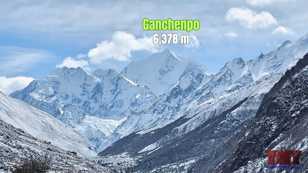
Ganchenpo is 6,378 m (about 20,925 ft) high as per Nepal’s official records, but some maps may show 6,387 m (20,955 ft).
Both numbers are in wide use, but since we follow Nepal’s records here, we have listed the height as 6,378 m!
The gap of 9 m comes from different maps, not from a new measurement.
Where is Ganchenpo Located?
Ganchenpo is in Rasuwa District of Bagmati Province, inside Langtang National Park. Its summit is at 28°10′08″N, 85°40′52″E.
Water from Ganchenpo’s slopes drains to the Langtang Khola and on to the Bhotekoshi River, which later joins the Trishuli River near Dhunche.
Mountains right next to Ganchenpo are: Urkenmang (6,150 m) to its east, Pongen Dopku (5,928 m) and Dshabu Ri (4,943 m) to its west, Bhemdang Ri (6,150 m), Bhemdang Karpo (5,691 m), and Ghanna (5,995 m) to its north, Langshisha Ri (6,412 m) to its north-east, Yala Peak (5,732 m), Yala Peak South (5,520 m), and Tsergo Ri (4,985 m) to its north-west, and Tembalthang (5,712 m) to its south-west.
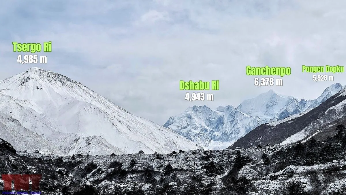
The popular neighboring mountains are:
| Neighbour | Height | Position and note |
|---|---|---|
| Langshisa Ri | 6,412 m | About 6.6 km north-east of Ganchenpo, in the Jugal Himal. First climbed on 23 April 1982. |
| Dorje Lyakpa | 6,966 m | To the east, in the Jugal Himal. First climbed on 16 October 1981. |
| Langtang Lirung | 7,234 m | Across the valley to the north-west, in the Langtang Himal. First climbed on 24 October 1978. |
| Naya Khanga (Ghanja La Chuli) | 5,836 m | A popular trekking peak located near the Ganja La pass, west of Ganchenpo and part of Jugal Himal. |
From the summit, a panorama published in the American Alpine Journal says you get close views of Langtang Lirung, Kimshung, Dragpoche, Langtang Ri, Shishapangma, Langshisa Ri, and Dorje Lyakpa.
Where to See Ganchenpo From?
While scaling Ganchenpo requires a full mountaineering expedition, admiring its graceful, fluted ice ridges doesn’t demand technical climbing. Because the mountain sits proudly at the head of the Langtang Valley, several stunning viewpoints along the main trekking routes and high ridges offer front-row seats to its striking silhouette.
Whether you are walking the valley floor or ascending high altitude acclimatization points, here are the best places to witness Ganchenpo in all its glory:
On the Langtang Valley Trek
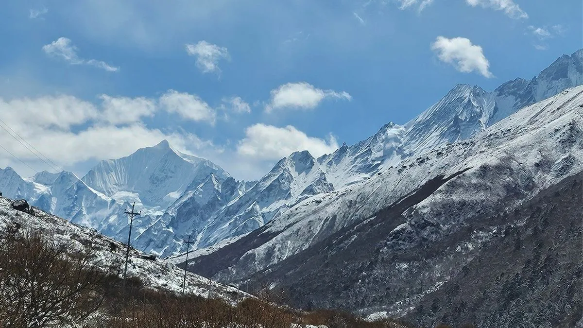
Ganchenpo shows up clearly once you cross Langtang village and the valley keeps opening toward Mundu and Sindhum.
Ask every Langtang trekker and they’ll describe to you what walking the level valley floor toward the graceful Ganchempo at the valley head feels like!
Upon reaching Kyanjin Gompa (3,870 m), the view is perhaps the best! Moreover, Ganchenpo is also visible from the summit of Tsergo Ri at 4,985 m.
Beyond Kyanjin: Langshisha Kharka and Yala Peak
This is where Ganchenpo gets close! The fluted summit ridge from Langshisha Kharka can be described as an ice sculpture, silhouetted at dawn and pink at sunset!
Higher up, from Morimoto Peak Base Camp, it looks disfigured from that angle. And the remote Tilman’s Pass route that takes you to Panch Pokhari beneath Ganchenpo is quite hazardous!
Moreover, Ganchenpo is one of the summit views from Yala Peak too. You get to see breathtaking views of its ridges and icy faces from the trail to Yala Kharka.
However, note that Yala Peak is a climb, so this is not for general trekkers!
Other Treks and Places Where Ganchenpo is Visible
Almost every route that shows Ganchenpo goes through the upper Langtang Valley, so the list is shorter than you might hope:
- Ganja La Pass trek (5,122 m): This crosses from Langtang toward Helambu. On this trek, you get to see both Ganchenpo and Langshisa Ri.
- Langtang Gosaikunda and Tamang Heritage routes: You see it only on the Langtang Valley section when the weather favors you! Views from Gosaikunda, Laurebina/Suryakunda Pass, or Helambu isn’t possible. But when viewing the Langtang range from Lauribina, you could indeed see it.
Faces and Climbing Routes of Ganchenpo
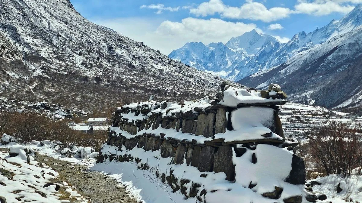
Ganchenpo has four sides that climbers have used: a fluted north-northwest face, a south face, a southeast ridge, and a west ridge, with the south ridge and southwest ridge also on record.
The side that looks toward the Langtang Valley (i.e., the north or northwest face) is the one that gave the mountain its English name.
| Side or ridge | What the record says |
|---|---|
| North-northwest face | Joshua Jarrín and Oswaldo Freire climbed it on 3 November 2023 via Cold Therapy, about 700 m, rated AI4+, with an average angle of 55°. David Goettler and Nicolas Hojac climbed a direct line to the west ridge on 15 November 2024, roughly 700 m at 65° to 70°, with sections of 80°. |
| South face | A Swiss team climbed the south face direct, reaching the summit on 15 October 1999. Also, Czech team climbed this face on 26 October 2024. |
| South-west ridge | The 1990 Nepal Police route used the south-west ridge, crossed the south face and finished by the east ridge. |
| South-east ridge | The 1971 Bech party’s route is recalled as the south-east ridge, or the east side of the south face. A Nepali team is recorded on the south-east face and ridge on 13 November 2024. |
| West ridge | A British team climbed the west ridge from the north in 1993. Goettler and Hojac’s 2024 climb topped out on this ridge, just right of the summit. |
Two details are useful if you are comparing routes:
- The 2023 team walked up the Nyangutse Chu, camped at 4,600 m on the west side of the mountain, and crossed the bergschrund at 5,600 m.
- The 2024 pair left Kyanjin Gompa, walked more than 5 hours to a camp at 4,760 m, and descended by what they called the standard route to the south-south-west.
The north-northwest face has also seen quiet attempts for decades. Several teams have climbed lines on it, though most were not direct, and three Italians claim a similar line in 2010. Moreover, unauthorized parties in the late 20th century are believed to have climbed it too.
Climbing History: Who Climbed Ganchenpo First?
The first known summit was reached in late October or early November 1971 by Terry and Cherie Bech, but that climb had no permit!
The first recorded permitted ascent was made by a Nepal Police expedition on 9 May 1990.
Here’s the expedition history of Ganchenpo:
| Year | What the record says |
|---|---|
| 1949 | Bill Tilman tried the mountain and turned back, judging the route to need too much step-cutting. It was a south-west ridge attempt. |
| 1964 | A British party led by the Earl of Shaftesbury and Ami Giroud tried the south ridge without reaching the summit. |
| 1971 | Terry and Cherie Bech reach the summit. |
| 1990 | On 9 May, nine members of a Nepal Police expedition reach the summit by the south-west ridge. |
| 1993 | A British team reaches about 6,000 m on the west ridge. A Japanese and Nepalese team summits on 28 April. |
| 1999 | A Swiss team climbs the south face, with Markus Baumann and Shyam Prasad Pun on top on 15 October. |
| 2014 | Evan Miles and Ibai Rico summit on 9 November by the south ridge. |
| 2023 | Joshua Jarrín and Oswaldo Freire climb the north-west face on 3 November. |
| 2024 | A Nepali team summits by the south-east ridge on 13 November, and David Goettler and Nicolas Hojak climb the north face on 15 November. |
The 1971 Ascent
Terry Bech, an American living in Kathmandu, led a party of four. His wife Cherie, an Australian nurse, reached the summit with him.
Al Read, a US Embassy officer who was at base camp, wrote in 2005 that he developed pulmonary edema at about 17,000 ft and went down with Jennifer Read.
Read also wrote that the peak was not on any Nepalese permitted list, so the climb was “not legal in any way“. He recalled the route as the south-east ridge, or the east side of the south face.
Why the Records Disagree?
Three answers circulate here:
- 1971 is the first known summit.
- 1990 is the first recorded permitted ascent. The 1991 American Alpine Journal report calls it the first ascent without mentioning the Bechs.
- 1993 appears in the Alpine Journal, which described the Japanese and Nepalese climb as the official ascent. That 1993 note seems to overlook the 1990 record!
Unauthorized climbing before the peak was opened is also part of the story. The American Alpine Journal says peaks far up the Langtang Valley were well known for unauthorised ascents, and that several teams have climbed lines on the north-west face!
Permits, Royalty and Rules
Ganchenpo is an expedition peak, not a trekking peak. And it also does not belong to the NMA 27 Peaks list (only Langshisha Ri from Jugal Himal Range is a part of it).
Since it is below 6,500 m, it sits in the “less than 6,500 m” category of Nepal’s peaks. Based on that, here are its climbing fees as of 2026:
| Season | Months | Foreign climbers (USD per person) | Nepali climbers (NPR per person) |
|---|---|---|---|
| Spring | March to May | 350 | 20,000 |
| Autumn | September to November | 175 | 10,000 |
| Winter and summer | December to February, June to August | 175 | 5,000 |
Other rules that you should know:
- Under the Nepal Gazette amendment, teams on peaks below 8,000 m must take at least one mountain guide.
- You’re also required to pay the Langtang National Park entry fee, which costs NPR 3,000 for foreign visitors and NPR 1,000 for SAARC nationals. Even Nepalese need to pay NPR 100 as an entrance fee.
- Expeditions also pay a refundable garbage-management deposit. You can talk about the total fee with your agency before booking.
Final Words
What to remember about Ganchenpo? Well, it is a 6,378 m mountain with a name shared with a second peak and a first-ascent story that has three versions!
The documents support 1971 as the first known summit, 1990 as the first recorded permitted ascent, and a steady rise in new routes since 2023.
For planning, the key facts are that it is an expedition peak, the royalty band for peaks below 6,500 m applies, and note that access to Langtang has changed since the August 2026 flood.
For readers who only want to see it, trekking to Langtang Valley offers the best views without any climbing. Happy travelling!
About The Author