Key Takeaways:
- Larke Pass (Larkya La) is the 5,106 m high point of the Manaslu Circuit.
- It joins Gorkha and Manang, between Dharmasala (4,480 m) and Bhimthang (3,700 m).
- “La” means pass, so saying Larke Pass, Larkya La, and Larke La are all correct.
- Gorkha holds the Dharmasala side, while Manang holds the top and Bhimthang side.
- Larke Pass comes on day 8 or later on the Manaslu Circuit Trek, and was my 8th walking day.
- The standard route’s biggest night gain is +620 m, while that of reverse is +1,700 m in just two days.
- Reverse is possible, but acclimatization and a steeper slope make it riskier.
- Leave Dharamshala by 3:30 to 4:30 am; the whole crossing takes about 10 hours.
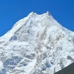
- The prominent mountains seen are Samdo Peak, Tasa Peak, Pangpoche I, Larkya Peak, Naike Peak, Gyala Peak, Nemjung, Gyaji Kang, Chombi, Kanguru, Pisang Peak, and some peaks of the Annapurna Range.
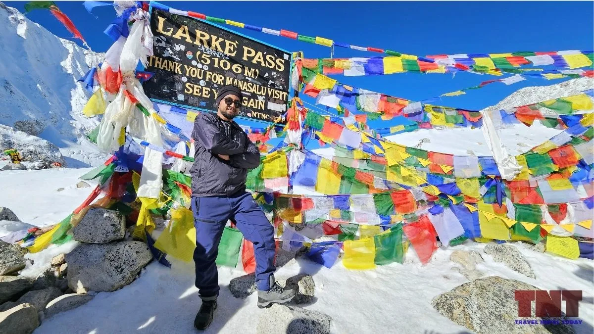
I crossed Larke Pass in October 2025, and it was my first time above 5,000 m. I had done around 10 treks before, and none of them had prepared me for a day like this one!
The weather was perfect, with blue skies, and I was still unprepared in more ways than one: no proper clothing, a late start, no crampons of my own, no sleeping bag, and no headlight. I will tell you exactly what went wrong and what I would change in this blog.
My Manaslu Circuit Trek was sponsored by Altitude Himalaya, where I lead multiple content writers who also eagerly share their experiences just like I do. I’ve shared a longer Manaslu Circuit guide there along with a dedicated package that you can book so you don’t have to worry about logistics (so, do check it out).
This guide here on Travel Nepal Today is the Larke Pass part, with the facts checked and my mistakes kept in!
Key Facts About Larke Pass
Larke Pass is a high mountain pass, with the highest point at 5,106 m, sitting between Dharmasala and Bhimthang and joining the Gorkha and Manang districts of Gandaki Province.
| Fact | Detail |
|---|---|
| Alternative Names | Larkya La, Larke La (“la” means pass) |
| Highest Point | 5,106 m (16,752 ft) |
| Coordinates | 28° 39′ 40.5″ N, 84° 30′ 32.0″ E |
| Districts | Gorkha (Dharmasala side) and Manang (High Camp side) |
| Local Governments | Chumnubri Rural Municipality (Gorkha) and Nason Rural Municipality (Manang) |
| Day Starts from | Dharmasala (Larkya Phedi) at 4,480 m |
| Day Ends at | Bhimthang (3,700 m) |
| Protected Areas | Manaslu Conservation Area (MCA) and Annapurna Conservation Area (ACA). The vantage point is at ACA. |
| Climb from Dharmasala | About 4 to 6 hours (depends on weather and snow conditions) |
| Main Mountain Views | Pangpoche Himal, Kanguru, Gyaji Kang, Nemjung, Himjung, Panbari, and Himlung |
How High Is Larke Pass?
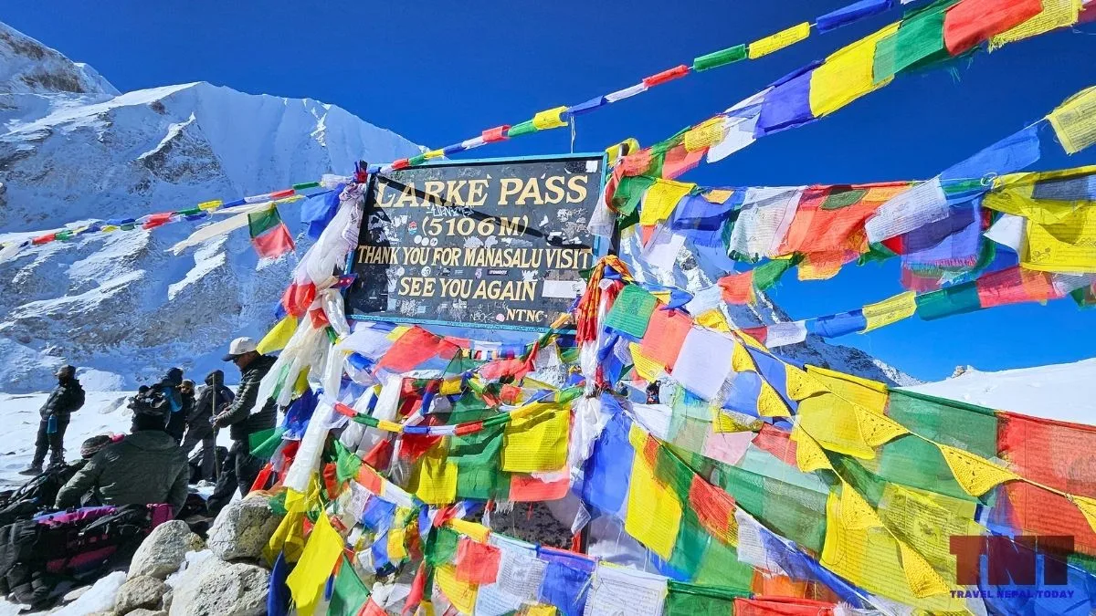
Larke Pass is 5,106 m on the signboard, but no one has surveyed the exact crossing point, so treat 5,106 m as the working figure!
One important thing though: a pass is not the same as a summit. As I learned on the trail, a pass is the whole route that connects two places, which here means Manaslu’s Budhi Gandaki valley and Manang’s Marsyangdi side.
The high point of 5,416 m is only one stretch of it! The pass is not sharp-edged; it just seems to go on and on.
What Does Larke Pass or Larkya La Mean?
“La” means pass, so Larke Pass, Larkya La and Larke La all name the same crossing, and none of them is the wrong one to say.
The older spelling was Larkya, and over time most trekkers started saying Larke because it is easier to pronounce. That means Larke La Pass is a little redundant, since “pass” is already in the word “la“, but you will hear all these from guides and lodge owners!
The base of the climb carries its own name! Dharmasala is also called Larkya Phedi, and “phedi” is Nepali for the foot of a hill. Just below it sits Larkya Bazaar, the old trading spot where Tibetan traders once set up.
As for what “Larkya” itself means: in regional Himalayan usage, the name often relates to Lhargyal La, translating to “victory hill” in Tibetan-influenced dialects.
Is Larke Pass in Gorkha or Manang?
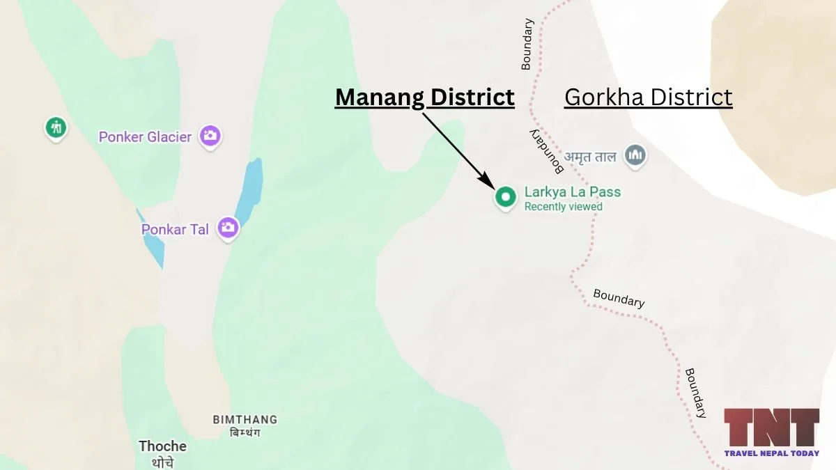
Larke Pass joins two districts: the Samdo and Dharmasala side is in Gorkha, and the Bhimthang side is in Manang, with the district line running along the crest.
Many pages say the pass is in Gorkha, because the Manaslu Circuit starts there. That is half right!
As I mentioned earlier, “pass” doesn’t mean the highest point but rather a long route that connects two geographical regions. So, yes, part of the Larke Pass is in fact in Gorkha.
However, the other half (including the 5,106 m top part of the pass) belongs to Manang!
If you’re walking with the right trekking guide, he/she will likely tell you halfway across the pass that you have entered another district. And if you want to trek with such a knowledgeable guide, just fill out our form, and we’ll help you out!
The same split shows up in the permits. You enter on the Manaslu Conservation Area permit, and you leave under the Annapurna Conservation Area permit, which is why the Manaslu Circuit needs both!
Which Day is Larke Pass on the Manaslu Circuit Trek?
Larke Pass is the high point of the Manaslu Circuit, normally reached on Day 8 or later after Lho/Shyala, Samagaon (Sama Gaun), Samdo, and Dharmashala. On my trek, it was the 8th walking day (ninth in overall trip)!
The circuit goes anticlockwise around the Manaslu massif: up the Budhi Gandaki valley, over Larke Pass, and down through Bhimtang and the Dudh Khola to Dharapani, where it joins the Annapurna Circuit.
The order matters because of altitude, and I did a little math to show how!
Why the Standard Direction Works Better?
To check the climb against the standard guideline, I took the sleeping elevations of the usual stops and worked out the gain each night. The method is simple: subtract the night before from the night after.
The guideline, from the CDC Yellow Book 2024 is to raise your sleeping elevation by no more than about 500 m a night above 3,000 m, with an extra night for every 1,000 m gained.
| Night | Sleeping elevation | Gain from the night before | Against the 500 m guideline |
|---|---|---|---|
| Lho (most common, but I chose to stay in Shyala) | 3,135 m | +1,030 m (supposed you stay at Ghap/Gap) | Lower altitude, so less risky |
| Samagaon | 3,530 m | +395 m | Within |
| Samdo | 3,860 m | +330 m | Within |
| Dharmasala | 4,480 m | +620 m | Over by 120 m (slightly high, so I recommend going for a short acclimatization hike; that way, you follow the “climb high, sleep low” principle) |
| Bhimthang | 3,700 m | -780 m | Sleeping lower after the pass |
| Night | Sleeping elevation | Gain from the night before | Against the 500 m guideline |
|---|---|---|---|
| Dharapani | 1,900 m | +1,140 m (supposed Besisahar) | Below 3,000 m |
| Surki Khola | 2,700 m | +800 m | Below 3,000 m |
| Bhimthang | 3,700 m | +1000 m | Over by 500 m |
| High Camp | 4,400 m | +700 m | Over by 200 m |
| Samdo | 3,860 m | -540 m | Sleeping lower after the pass |
| Factor | Standard | Reverse |
|---|---|---|
| Climb on pass day, from wake-up to the pass | +626 m | +706 m (approx. 100 m more) |
| Largest night gain above 3,000 m | +620 m (Samdo to Dharamshala) | +1,000 m (Surki Khola to Bhimthang) and +700 m (Bhimthang to High Camp), i.e., +1700 m in just two days and +2500 m in 3 days [Tip: If you really want to try the reverse route, keep an acclimatization day in Bhimthang] |
| Night after the pass | -770 m (Bhimtang) | -540 m (Dharmasala) |
| Average slope of the long pass-side hill | about 9% (626 m over about 7 km, east side) | about 15 to 20% (1,400 m over about 7 to 9 km, west |
Can You Cross Larke Pass in Reverse From Bhimtang?
Yes, you can cross from Bhimtang to Dharmasala, but I do not recommend it, because the acclimatization and the black-ice slope are working against you.
After the September 2026 flood that closed the Manaslu trail, a few friends asked me about the opposite direction. I met a group that did it during my own trek, so it can be done.
So, why is the standard direction better? Four reasons, each backed by something I checked:
- It acclimatizes you slowly from the start: The route begins at about 870 m and averages about 500 m of gain a night. This direction gives the gradual altitude gain that acclimatization requires.
- You spend 5 nights above 3,000 m before the pass, not 2: You go slow and on top of that, there’s usually a rest day at Samagaun too.
- The last stage before the pass is short: Samdo to Dharmasala takes a little over 3 hours, and Dharmasala has proper drinking water facilities (although charges are high) where even a litre of bottled water might be enough for the pass. In reverse, you would find no water on the scree slope, which a decent high camp needs. A bottle of water from the High Camp lodge? I don’t think that would be enough!
- The approach is gentle: The climb from Dharamshala follows a moraine and then a broad, flat glacier floor that is unproblematic for most walkers. The west side is roughly twice as steep, on scree and old moraine.
What the Larke Pass Day Looks Like?
The crossing is one long day: you need to leave Dharamshala between 3:30 and 4:30 am, climb for 4 to 5 hours (up to 6 in bad weather), then descend about 1,400 m to Bhimthang!
My own numbers were a little over 7 km, and it took about 4.5 hours to reach the top, while we were warned it could take 6 hours because of the slippery, icy trail. Overall, it was a 16 km hike in about 10 hours (from Dharamshala to Bhimthang).
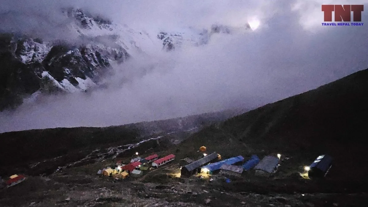
Note: Dharamshala has a handful of lodges that fill up fast in peak weeks, so carry a sleeping bag and confirm your beds through your agency. For me, Dharamshala was one of the worst teahouse experiences I have had, and I cannot complain too much, because that is how mountain camps work. Do not expect the best services here, and do not expect a room in the week that postponed treks all collide. In crowded days, you may need to adjust in a tent (could even be a shared one).
From Dharamshala, the trail follows the northern edge of the Larkya Glacier moraine. At about 4,900 m, the trail steps onto the glacier itself, where ice and rubble alternate on a wide, flat surface.
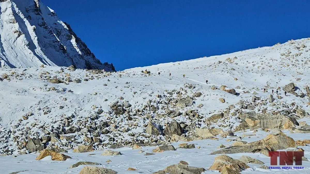
So, if you ask whether Larke Pass crosses a glacier, the answer is yes, on the way up!
At the top, the prayer flags mark the crossing, but the descent does not start there. You need to walk more than 1 km west over the rubble of a former glacier, with no loss of height, before the big western view opens!
Then comes the drop: old moraine debris down to about 4,500 m, the side moraine of the Salpudada Glacier, a green valley from about 4,350 m, Ponkar Tal (Ponkar Lake, 4,097 m) and, at about 3,900 m, your first sight of Bhimthang!
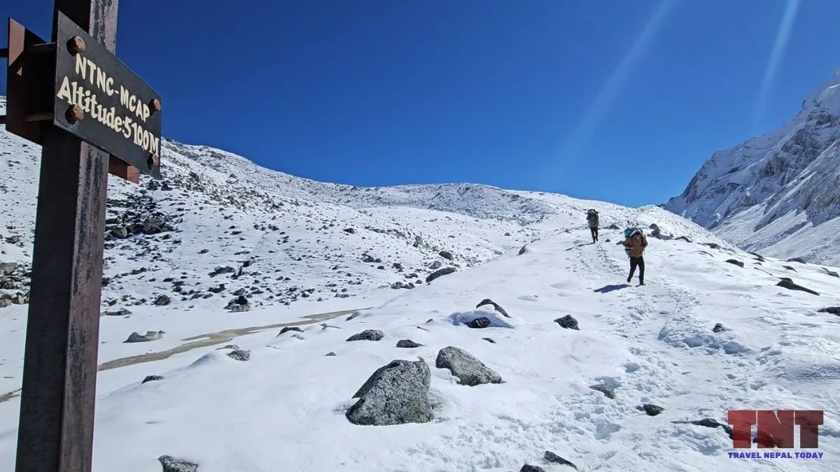
Honestly, coming down is the hardest part of this trek, especially when the snow has started to melt. I still see myself slipping on a patch of black ice near a drop. I stayed on my feet with one trekking stick and one crampon, and that was the moment I understood that glaciers and mountains are not just for fun.
That knee-hurting downhill was something I had never experienced before! I even thought about a mule ride all the way to Tilche the same day. Yes, these animals are available for those who get injured (but only from High Camp or Bhimthang onwards).
My suggestion is to go slow, rest, and start early rather than hurrying, because hurrying at that height raises the chance of altitude sickness.
There are no teahouses between Dharamshala and the Annapurna side, so carry snacks in your pocket (a chocolate bar or protein bar would be fine) and a full bottle of water for the 6 to 7 hours of walking.
The elevation boards put on by the Manaslu Conservation Area Project (MCAP) along the climb helped my head: I patted myself on the back with every one I passed!
And keep one rule in your pocket too: if you feel properly unwell, turn back and try again the next day, because the pass will still be there.
Note: The pass is a broad, uneven area of glacier debris, and the two signboards stand about a minute apart on it, which is why the top can feel like two summits. The first board is the one almost everyone photographs. The second is about 2 minutes further along, and in peak season both get crowded, so I only managed a photo at the first. Moreover, the crossing is not a sharp high point but a wide, uneven plain.
Mountain Views From Larke Pass
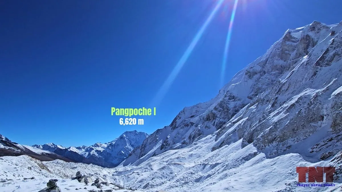
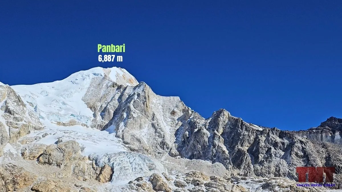
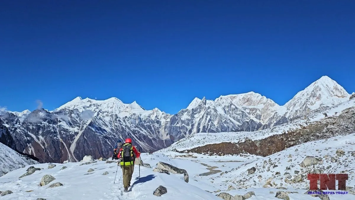
From the crossing, you see Pangpoche I and Samdo Peak behind you and Larkya and Naike Peaks beside you, the Annapurna range opens as you keep walking west, while Manaslu itself remains hidden!
Here are all the major peaks that you see at and near Larke Pass:
| Where you look | Direction | What you see |
|---|---|---|
| Behind you, the Dharmasala side | East | Samdo Peak (5,177 m), Tasa Peak (5,543 m), and Pangpoche I (6,620 m) is the prominent one |
| Right beside you | South | Larkya Peak (6,249 m) and Naike Peak (6,211 m) |
| On your left | North-east | Gyala Peak (5,973 m) and other Tibetan peaks, with spme being unnamed |
| Walking west, past the board | West and south-west | The Annapurna range opens up: Lamjung, Annapurna II, Annapurna IV, Annapurna III and Gangapurna |
| Further along the walk | West | Panbari I, Nemjung, Gyaji Kang, Chombi, Kanguru and Pisang Peak dominate |
What about Manaslu? It is not visible!
Larkya Peak blocks the view of the mountains behind it, which are Manaslu, Manaslu North and Thulagi Chuli. You see Manaslu from Bhimthang, but not from the crossing!
Here is the honest part: the views from the pass are not the best of the Manaslu Circuit. The sunrise viewpoint and the Amrit Lake you pass are good resting spots, but Birendra Lake and Pungen Gumba give you better mountain views for far less effort.
Larke Pass Weather and the Best Time to Cross?
Larke Pass is clearest and most crowded in post-monsoon autumn, but the dated record shows the weather can flip even then, so build in spare days and start before 4:30 am!
I crossed in October 2025 under blue skies, with earlier snowfall that had started to melt, but the trail was walkable. That was the luckiest window of the season, because of what came next!
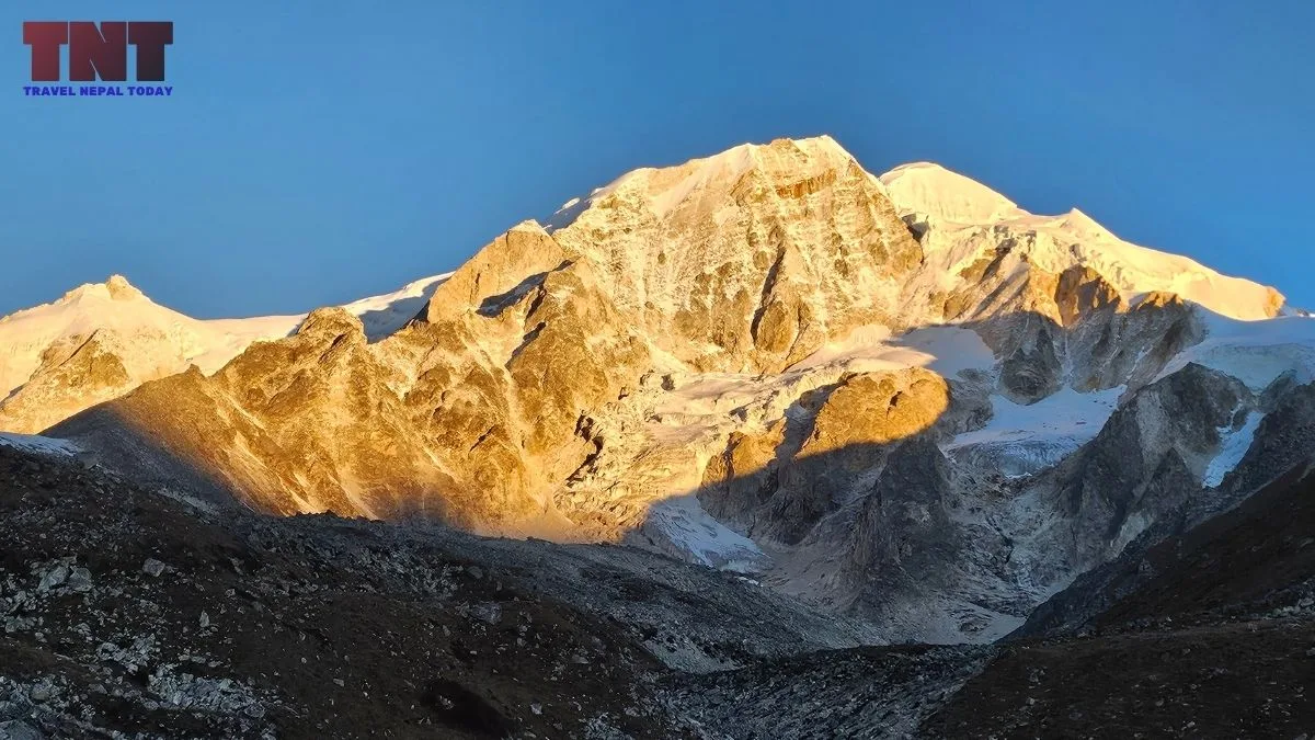
The record for late October 2025:
- Snow began on the night of October 26 to 27 in the Manaslu region. By October 28, Samagaun, Syala and Lho were covered in snow, and the DHM (Department of Hydrology and Meteorology) linked it to westerly winds meeting a low-pressure system over the Arabian Sea.
- More than 100 foreign tourists were held at Samdo, and, according to local sources, snowfall had exceeded 1 m!
- The Gorkha District Administration Office asked people not to trek until Kartik 16 (November 1), and police said 460 tourists who had gone toward Larke Pass returned from Samagaun.
So, October is not a guarantee, and I’ve also explained why September isn’t the best time at all!
These aren’t the only risky months. On March 21, 2026, the Gorkha administration warned against trekking in the Manaslu region after two days of wind, lightning, heavy rain, and snow.
Wind is the other reason for the early start! Studies of Himalayan valleys such as the Khumbu, including one in Atmospheric Chemistry and Physics (2023), find weak night winds and well-defined daytime up-valley winds that peak in the afternoon.
Cold is the third. For me, it started to bite above 3,500 m, particularly crossing Shyala (the open stretch before Samagaun), well before the pass.
If I had to pick the best months, I’d say April to June and November. These are the times when weather is most stable. However, you still need to stick with checking the weather!
What I Got Wrong on My Crossing (So You Do Not!)
I made six mistakes on Larke Pass day, and every one of them has a simple fix:
- Clothing: I treated Manaslu as a general October trek and missed out on some important items. October winds and the cold above 3,500 m do not care. Carry a windproof shell, an insulating layer, a hat, and warm gloves, and keep them in your daypack, not in a porter’s bag.
- Start time: I knew the climb began in the morning, but I started a little later than planned (4:30 am instead of 3:30). Plan for 3-4 am (not 5 or 6), because the climb takes 4 to 5 hours and the wind builds later in the day.
- Crampons: I did not have my own. I was lucky to borrow one crampon from a pair, shared the other with a friend, and ended up on a black-ice descent with a stick and a single crampon. Carry or rent proper traction for both feet, and do not share a pair as I did!
- Sleeping bag: The trail was crowded because many trekkers had postponed their late September and early October plans. Our group of 4 got no room, no tent, and not even a mattress at Dharamshala (considering we are Nepalese and apparently can adjust, but for foreign trekkers, they’ll somehow manage a tent!). We slept on the dining room floor with daypacks as pillows and borrowed a blanket from the owner’s room. Carry a sleeping bag, and ask your agency to confirm where you will sleep!
- Torch: I crossed in half-sleep with no torch. Bring a headlamp with spare batteries, because cold drains them faster.
- Boots: I had worn the Goldstar G10-G2002, and I am not going to suggest them for a big trek like this one! Wear proper trekking boots that you have already walked in.
One thing that worked: I hired a porter at Samdo, and every step above 4,000 m felt easier. You see, these kinds of services are also available midway (however, charges are much higher)!
Altitude Sickness and Safety on the Pass
Above 3,000 m, the guideline is to raise your sleeping elevation by no more than about 500 m a night, and Larke Pass has already cost tons of lives. During my own adventure, we heard the news that a 23-year-old trekker died on the way to Larke Pass on October 10, 2025 (the day we were in Namrung).
AMS (acute mountain sickness) is the basic form of altitude illness, with headache, nausea, and poor sleep. HAPE (fluid in the lungs) and HACE (swelling of the brain) are the dangerous forms.
The CDC Yellow Book 2024 sets out three rules that work: know the early symptoms and admit when you have them, never go up to sleep higher with symptoms, and go down if they get worse.
I will not give medication doses here! Talk to your doctor before you travel about preventive medicine, including acetazolamide (Diamox).
On my trek, Day 9 was the 8th walking day, so acclimatization worked in my favour. I still had light headaches and a nosebleed at some points (small blood vessels cracking in dry, thin air), which was not a worry for me.
We were just 3 or 4 days behind the young man who passed away on the same trail, and it did scare me (along with plenty of others I had conversation with).
That news is also why I said no to Manaslu Base Camp. Heavy snow had made it difficult to reach, and after asking the locals, we decided against it. In fact, there was another group that did reach the base camp but had to return as they were overly exhausted!
Moreover, there was another Nepali guy who got really ill in Dharamshala, and our porter had to carry him to Samdo at midnight (thankfully, he was fine, as per the news we got from the locals).
For foreign trekkers, I’m not trying to scare you. This is a Himalayan trek and can happen in any other region too. Three things to do about it:
- Be sure that your travel insurance covers trekking above 5,000 m and helicopter evacuation, and note that rescue depends on a clear weather window!
- Agree a turn-back rule with your guide before the pass day. Remind yourself that if you cannot do it, you will return, and let that be the last choice.
- Remember the way down is the treatment. A report from April 2024 says that 4 foreign trekkers who got ill in Larke Pass were rescued from Bhimthang, and they were flown out by helicopter. The good part about this trek is that if you feel unwell at a high altitude, you can return to Dharamshala or Bhimthang, whichever is shorter (this is where your guide will help you).
Permits and Rules for Larke Pass
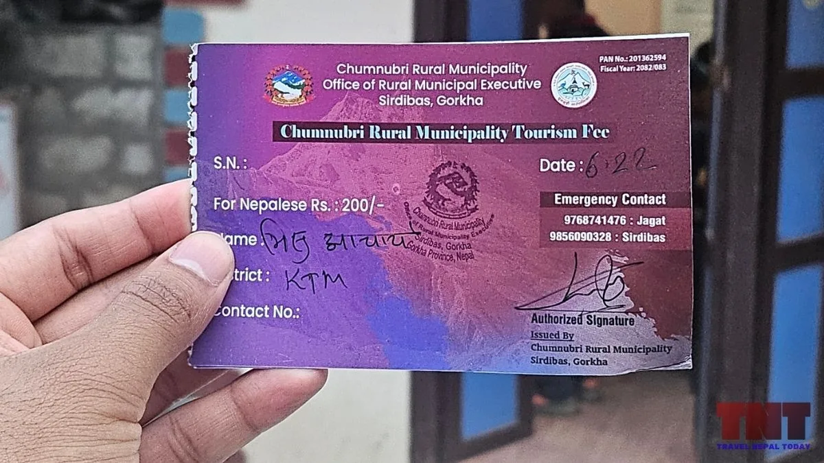
The Manaslu region is a restricted area, so the Department of Immigration issues the Restricted Area Permit, and only through a registered trekking agency!
On March 22, 2026, the department removed the two-trekker minimum for restricted areas, set a ceiling of 7 trekkers per guide, and said the agency is fully responsible for rescue and logistics.
Moreover, a licensed guide remains required. So, you can’t cross the Larke Pass all alone!
The Manaslu Conservation Area permit covers the way up, and the Annapurna Conservation Area permit covers the exit after crossing Larke.
Furthermore, a local Chumnubri fee is collected on the route at Jagat. It costs you an extra NPR 1,000 (for all foreigners), and even Nepalese need to pay NPR 200 here!
Final Thoughts
Larke Pass is overrated for views and underrated for what it does to you.
I went up with the wrong clothes, one crampon, and no sleeping bag, and I still came down grateful, because the mountain taught me more in one day than the previous 10 treks did!
Here is where I land:
- Do the crossing for the crossing, not for the photograph.
- If you want views, give your days to Birendra Lake and Pungen Gumba.
- If you want to cross the pass with less difficulty, start at 3 AM, carry your own traction for both feet, and bring a sleeping bag and a headlamp.
- Let the weather and your body decide, not the itinerary!
There’s one thing for sure: the descent will test your knees and the black ice will test your balance.
In case you’re not feeling well, don’t worry! Descend without risking your life! The pass will be there next week, but your health is the one thing you cannot reschedule.
Happy travelling to Gorkha and Manang!
About The Author